Rough Haw
The hill of Rough Haw, lying on the edge of the Yorkshire Dales
Location: SD 963 558
Getting there: Approach via the bridleway from the road to the south (there is space for a couple of cars, plus a couple of lay-bys on the road), or from the villages of Flasby and Hetton to the north via the same bridleway. Possible to start from Skipton if you fancy a longer route.
Height (at cairn on summit): 338m
Prominence: 46m
Map: OS Explorer OL2 Yorkshire Dales Southern and Western areas
This oddly-shaped hill is overshadowed by its taller pointy neighbour, but a hidden history and glorious views into the heart of the Yorkshire Dales can be found on its flat summit.

Rough Haw provides unobstructed views into the heart of the Yorkshire Dales
Like its spikier companion, Sharp Haw, Rough Haw had long been on my radar as it loomed on the skyline on my many road journeys into the Yorkshire Dales. Missing out on this hill on my first visit to the area earlier this year, its easy access from Skipton meant it was only a matter of time before I gave into the urge to explore this hill.
Its diminutive size and accessibility means Rough Haw is a good option for getting smaller kids into hill walking, but it also boasts an under-the-radar popularity within the bouldering community. Its north face in particular contains a number interesting problems

To the left: The north face of Rough Haw is good bouldering territory
This hill is eminently accessible however, and although there are no formal paths to the summit, a bridleway runs across its western flank, connecting Sharp Haw to the village of Flasby. From here, a number of sheep tracks lead up to the plateau.
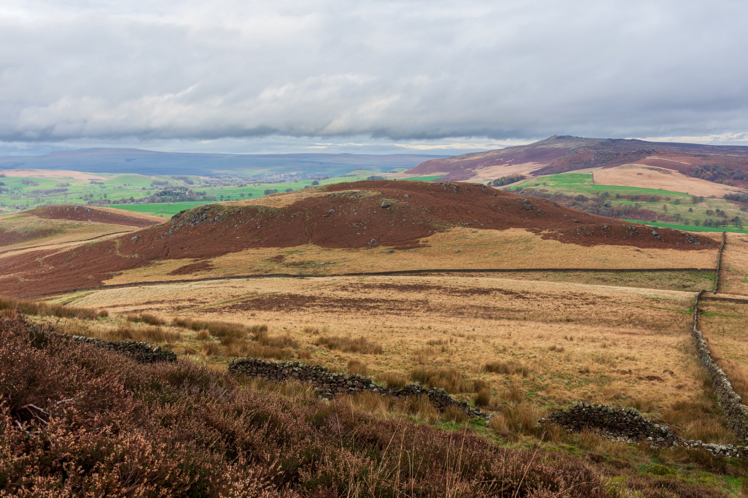
Looking down at Rough Haw from neighbouring Sharp Haw
A pair of cairns sit atop the plateau, but more interesting is evidence of a previous significant structure near one of the cairns. It is believed that these are the remains of an Iron Age fort that once sat upon the hill, and are accompanied by a number of cup marks in the surrounding rocks.

Evidence of an Iron Age fort that once sat on Rough Haw
The views from the top and the proximity of the River Aire would certainly have benefitted an ancient fort. Commanding the valley across the neighbouring Cracoe Fell, views to the south stretch to Ilkely Moor and the Haworth Moors, and to the north Great Whernside, Buckden Pike of Upper Wharfedale, and even the odd-hump of Meugher in Nidderdale are visible.


