Cracoe Fell
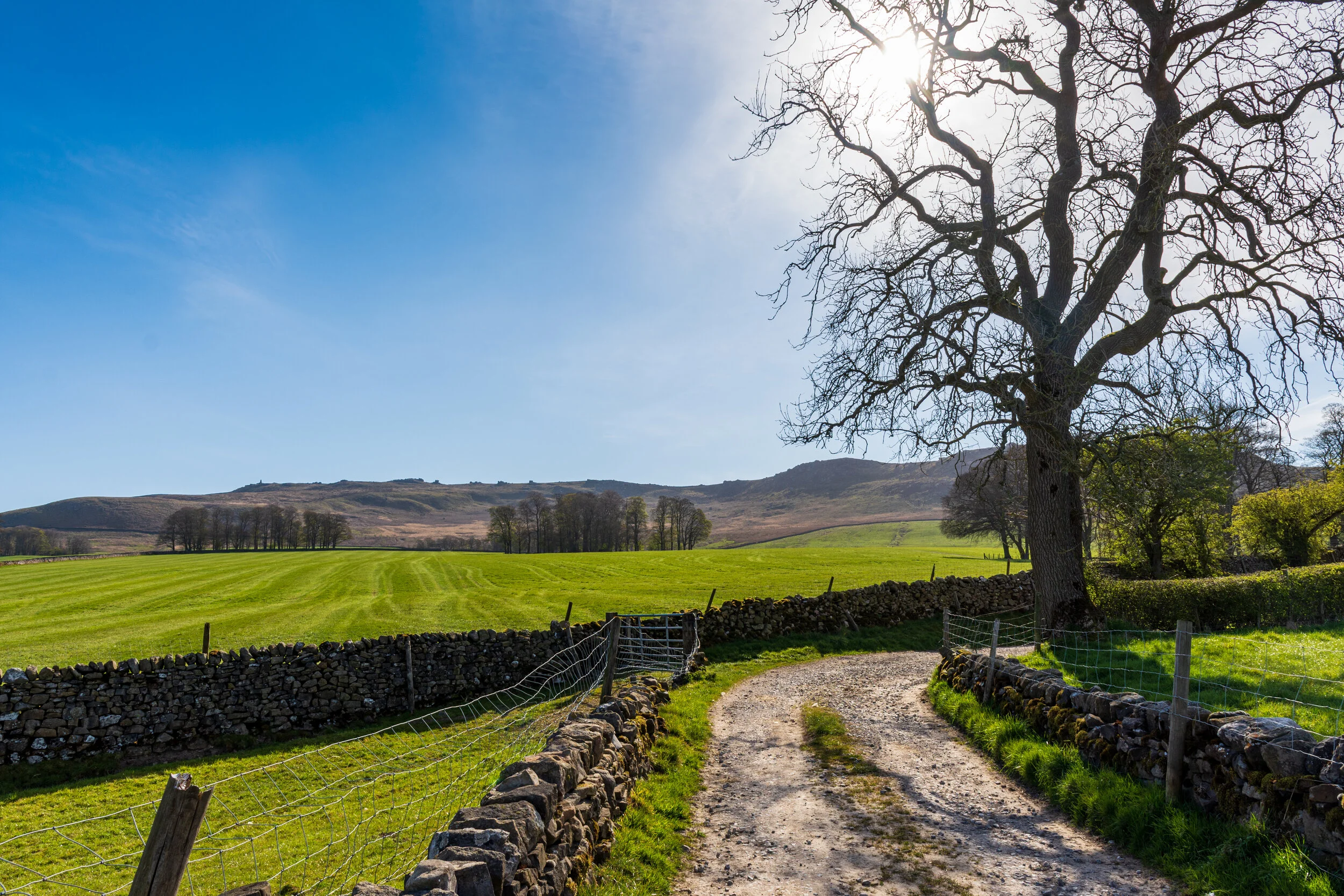
The western approach to Cracoe Fell
Location (Highest Point at War Memorial): SD 993 588
Getting there: Multiple approaches - from all directions - park near Rylstone for the War Memorial and cross, Embsay for the south of the moor and Embsay Crag, or Barden Bridge to explore the east and Thorpe Fell Top.
Height (at war memroial): 508m
Prominence: 308m
Map: OL2 Yorkshire Dales (Southern and Western Area - get it here)
Easily accessible, yet with so much to explore, the high moors to the north of Skipton, comprising Cracoe Fell, Thorpe Fell, Rylstone Fell and Barden Fell offer easily a full day of exciting exploration.
Where to start on this expansive moor, seemingly desolate and empty at first sight?
Very little on the top of the fells exists in the way of ancient sites, however Elbolton Cave to the north was discovered to be a burial place dating back to the Neolithic and Bronze Age.
The area is packed full of more recent human history, with just about every resource the land has to offer having been exploited in our recent past.
Starting on the slopes of Rylstone Fell are the remains of Norton Tower, built to project power over the hunting lands on the hill, but ruined in 1569 as an direct result of its owners’ involvement in the Rising of the North. The broader area was managed as grouse shooting moorland until very recently, with numerous lines of grouse butts pocking the landscape, and a shooting hut still present on the southern reaches of the fell. As would be expected, grouse shooting has very much defined the fauna and flora on the fells - with heather dominant over a peat substrate, covering millstone grit.

The remains of Norton Tower, near Cracoe Fell
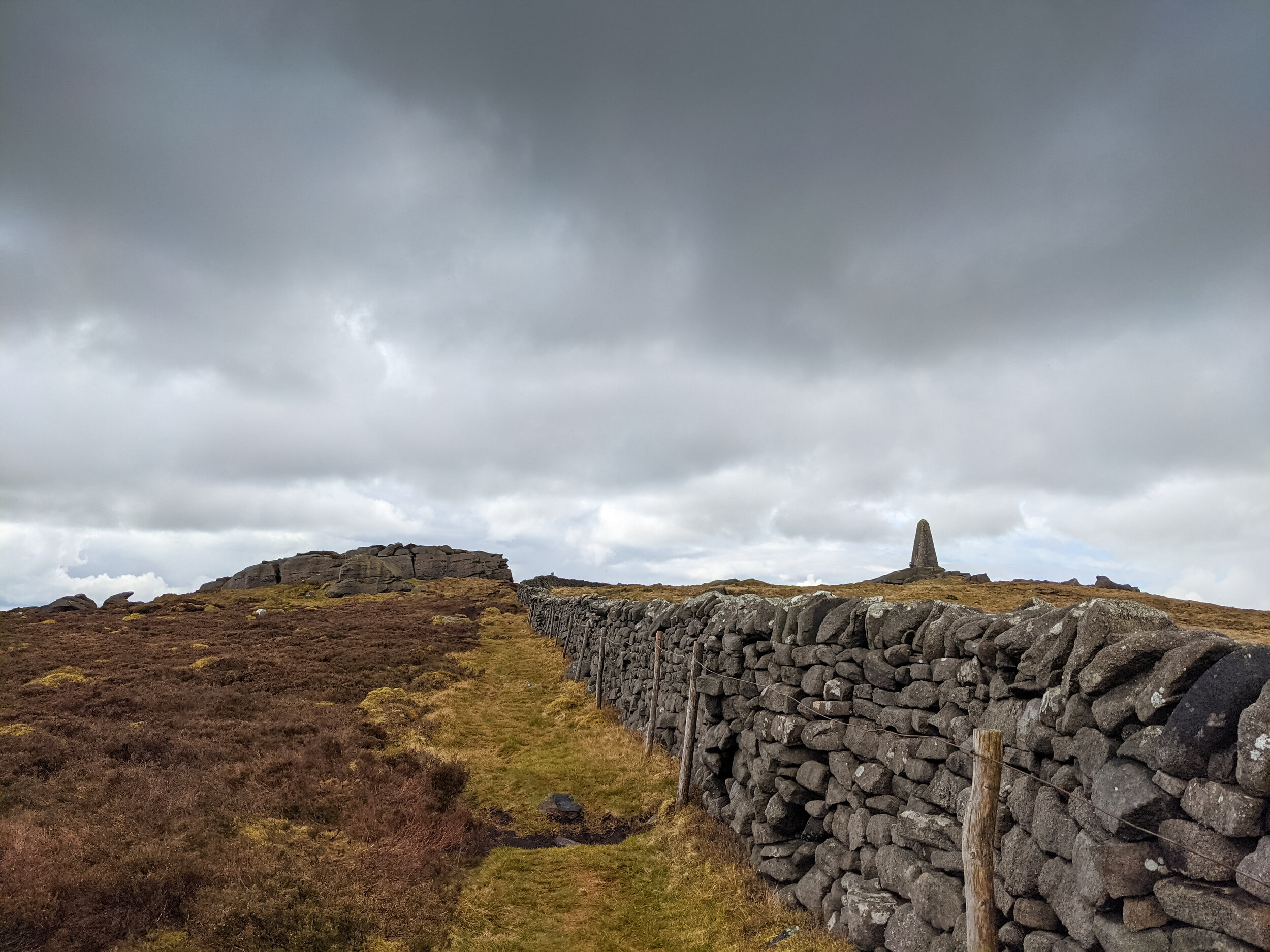
Several impressive grit outcrops can be found on the fell, some of the most prominent being along the edge of Cracoe Fell itself, extending south to Hellfield Crag (where the impressive and aptly-named ‘Waterfall Gill’ cuts through the rocks), through the trig point at Cookrise Crag Top, and down to Embsay Crag.

The trig point on Coockrise Crags, near Cracoe Fell
The Cookrise Crag trig point is well worth a visit for the views across the western Dales, particulalrly if it is via the surprisingly picturesque Waterfall Gill. On quiet days, it is lovely to sit on the rocks above the waterfall’s drop and take in the view.

Looking down Waterfall Gill on Cracoe Fell
Millstone grit was quarried extensively on Embsay Moor, with significant evidence of the quarry workings still scattered across the moor. The peat was also extracted to the north of the moor on Thorpe Fell, with several spoil heaps and shafts scattered amongst the peat hags.
There is also evidence of coal extraction in the area to the north of Embsay Crag, though little remains except evidence of a couple of shafts, and coal-ridden spoil heaps.
To the east of the fells lie the Upper and Lower Barden reservoirs. Taking advantage of the non-porous nature of the millstone grit that lines the moors, the lower reservoir was completed in 1860 and the upper reservoir in 1882.
The upper reservoir was notably celebrated during its construction and opening as being one of the first in England to use concrete extensively in the construction of the dam. A railway was built to transport the materials for construction from the navvy camp in the valley below (now the site of a car park).
The reservoirs were built to supply the nearby Nidd Aquaduct, supplying Bradford.

The Upper Baden Resevoir near Cracoe Fell
Given the peaceful nature of the moors today, it’s hard to imagine the once-busy industries that existed up here, likely at the same time.
Perhaps the most famous features of Cracoe Fell are the cross and obelisk that stand watch over Rylstone and the valley to the west.
Although there are accounts that suggest that there was originally a cross on Rylstone Fell from 1783, to celebrate the end of the American War of Independence, what we do know is that the sandstone pillar that the Rylstone Cross it is erected upon, was built in 1815 to celebrate the Peace of Paris, which formally concluded the Napoleonic Wars. Built by the local population who wanted to celebrate Napolean’s defeat, but who lacked the money to provide a grand gesture in the form of a monument, the pillar was carved out of the existing rock on the hillside, and moved to the position it now occupies.
The cross came some 50 years later, and was erected atop the pillar to mark Queen Victoria’s golden jubilee. Over the years, both the cross and the pillar fell into disrepair, and were fixed again, before finally, the current concrete cross was erected in 1995.

The now-concrete Rylstone Cross on Cracoe Fell
The Cracoe War Memorial has a simpler history. It was built in 1922 from gritstone as a memorial for Cracoe’s 13 fallen soldiers. Three additional names were added after the second world war. The lower section is hollow and contains a time capsule.
The War Memorial on Cracoe Fell
A final point of interest worth exploring on the moors is the trig point at Thorpe Fell Top. A peaceful location, with no formal path to reach it, there are some fine views over Wharfedale and the surrounding hills. The trig point is not one of the best maintained in the Dales, and the neglect well-reflects the recent change in status of the hill. Originally considered to be the highest point of the moors, and therefore listed as both a Marilyn and Dewey, it was recently discovered that the land at the war memorial was at least two metres higher. The hill lost its status overnight, but I’d still recommend heading out to here, using the path to the north, rather than navigating the peat hags from the reservoir (ask me how I know!)
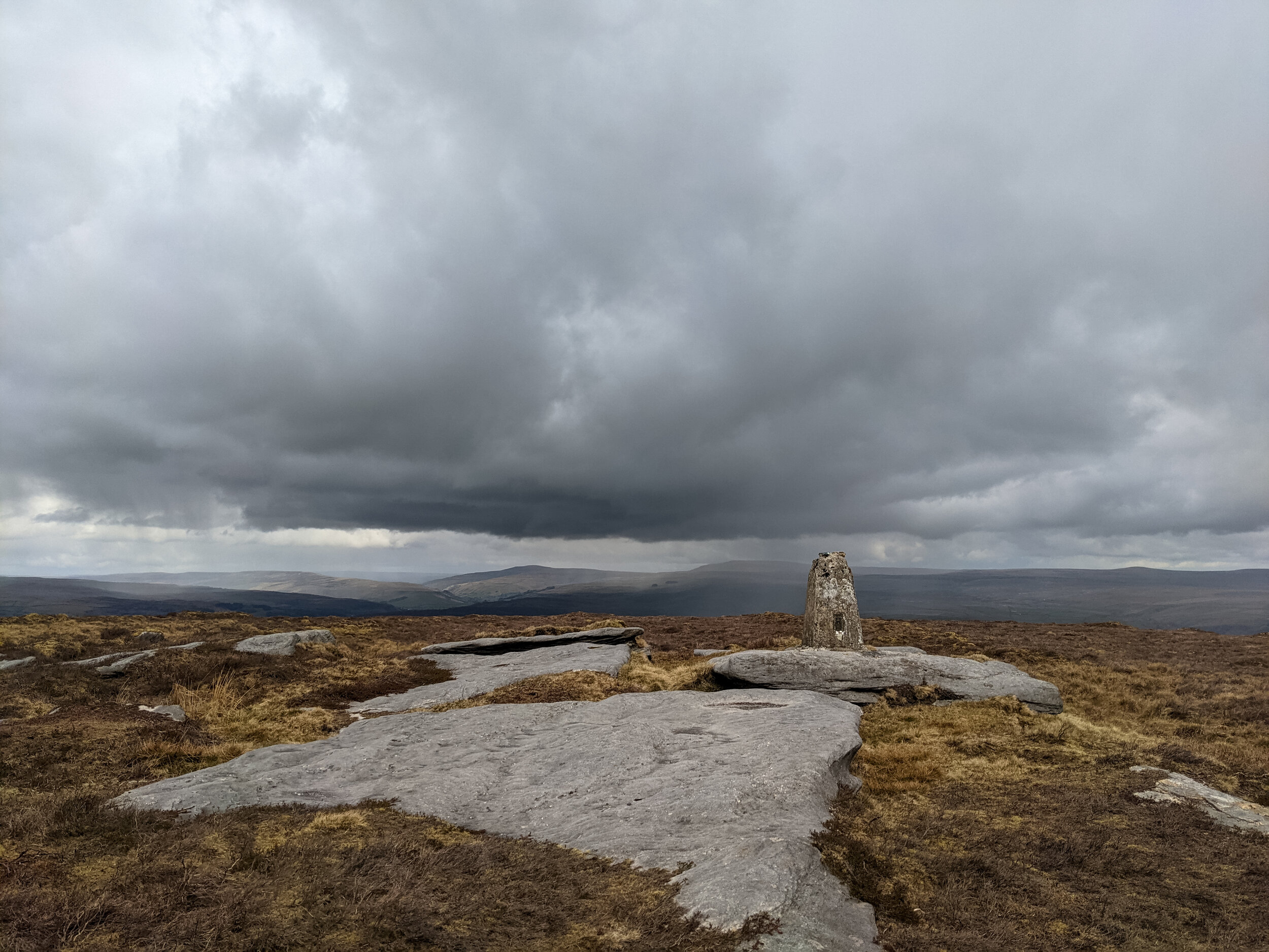
The lonely and forgotten trig point at Thorpe Fell Top near Cracoe Fell


