Yockenthawite Moor

Yockenthwaite Moor on the right, heading up Upper Wharfedale
Location: SD 909 811
Getting there: There are no straight-forward approaches. From the south, a track leads from the village of Yockenthwaite up to approx. 450m, and then there’s a climb up over open moorland to the summit (the summit is not visible on the climb, so you’ll need navigational aids). Or approach from the east from Gilbert Lane, with tracks leading onto the moor, but again, you’ll need to head off path to get the summit.
Height (at trig point on summit): 643m
Prominence: 86m
Map: OS Explorer OL30 Yorkshire Dales Northern and Central areas (get it here)
The ‘boggiest hill in Yorkshire’, this summit overlooking one of the most picturesque parts of the Dales is notoriously inaccessible and difficult to traverse.

The pathless and boggy Yockenthwaite Moor
Yockenthwaite first arrived on my radar when discussing possible walk locations for an upcoming session with a client. They mentioned Yockenthwaite was one of their favourite places, and intrigued, I did a bit of research, and came across stories of thigh-deep mud and warnings to avoid the moor at all costs. Needless to say, we chose another location, but I was strangely intrigued by this forbidding moor, guarding the entrance to one of the most stunningly beautiful dales in the national park.
For starters, it is technically a mountain, sitting at a proud 643m high, though it definitely has the feeling of a ‘big hill’ more than anything else. Its height also comfortably puts it into the ‘Dales 30’ list, and a trig point sitting on its top means it will always be attractive to ‘baggers, of no-one else.
But its attraction also lies in the tales of grit and sense of remoteness. There are so many easy-to-access beauty spots in the Dales which can easily become a victim of their own success, so to find somewhere notoriously inaccessible, and somewhere that takes a real effort to get to, ticks a lot of the boxes for me.
Okay, so confession: I embarked on my visit here at the height of summer, part way through one of the worst droughts in recent years, seemingly the conditions would never be better to take on this bog. Still, the ground was surprisingly soft throughout, and still incredibly boggy , despite the lack of rainfall.

The bog lives! Even drought can’t dry up Yockenthwaite Moor
The moor itself seems desolate, but its not without its history. A number of ruined buildings and sheepfolds litter the moor, and the northern slopes particularly have been heavily managed for grouse shooting, with a number of butts still set into the ground. A private road (public bridleway) crosses the moor to the east, seemingly providing a direct route to more capable vehicles, between Buckden and Semer Water. The remains of a settlement is marked on the map next to this track, though little remains other than a number of large stones strewn across the moor.
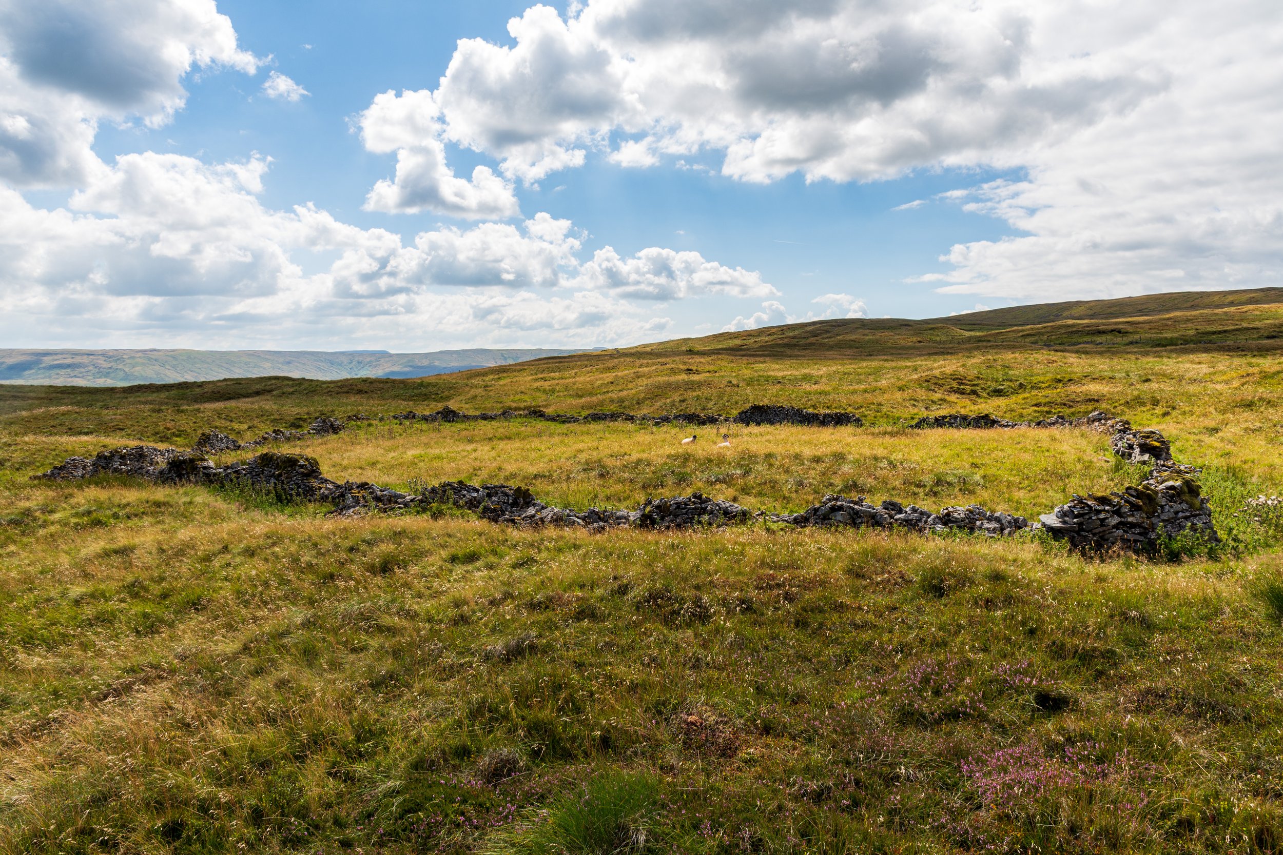
Three sheep enjoying the remains of an enclosure on top of Yockenthwaite Moor
To the south lie a couple of natural formations, Yockenthwaite Cave and Yockenthwaite Pot, and near these sit the very visible remains of ancient ring cairn.
On the summit, you are treated to a view of the both the Yorkshire Three Peaks and Wharfedale Three Peaks to the south on a clear day, with Wild Boar Fell visible to the north. More surprisingly, the northern edge of the North York Moors are also just visible when on the eastern side of the moor.
A weathered and neglected trig point sits atop the summit - it’s fair to say that it is not one that’s been deemed as worth the effort of keeping in good shape.

The weathered trig point on the summit of Yockenthwaite Moor, with Pen-y-Ghent, Ingleborough and Whernside in the background
There are a few options to reach the summit, though be warned: There genuinely are no paths that will take you up to the trig point. Approach from the hamlet of Yockenthwaite from the south, and a track will lead you up to the first exposed ‘edge’, but still it still peters out about 200m below the summit. From here, a slog up the grassy hillside is the only way to go, all the more morale-sapping given you don’t catch sight of the summit until the climb is pretty much over.
The approach from the west is somewhat more difficult - after ascending the moor via the aforementioned bridleway from the south west, you have a choice of crossing the boggy and peat hag-strewn moor for a more direct route to the summit, or carrying on to the northern part of the moor, where a hunters’ track will take you to back to within 1km of the summit. In fact, an approach from the more remote Stalling Busk and Semer Water from the north, using this same bridleway and track may appeal to those willing to drive a little further.
It would be a brave soul who would attempt to reach the summit from the road to the north east.


