Whernside

Location (summit): SD 738 814
Getting there: Most will approach on the Yorkshire Three Peaks path from Ribblehead viaduct where there is a good amount of parking, and a train station. Alternative approaches are from Chapel-le-Dale (no parking), Deepdale or from Great Knoutberry Hill to the north.
Height (marked by trig point on summit): 736m
Prominence: 408m
Map: OL2 Yorkshire Dales (Southern and Western Area)
The highest peak in the Yorkshire Dales, and one of the three peaks that make up the Yorkshire Three Peaks. It’s probably one that is the least recognisable - a long sloping ridge, running broadly north to south, towering over Ribblehead, with steep drops on its eastern side.
The name ‘Whernside’ derives from’ Quern’, the old English word for ‘Millstone’ and ‘side’, referring to ‘hillside’, so it’s no wonder that this hill is one of three in the Yorkshire Dales with a similar name!
It’s typically reached via its ‘Three Peaks’ paths - a slow but strenuous climb from the Ribblehead viaduct, or a steep path down its south eastern slope, meeting the Dales Way. It’s also possible to follow the ridge all the way from the south, approach from Great Knoutberry Hill and Blea Moor to the north east, take a path from Dentdale to the north, or take an off-piste route, via one of the several tarns or waterfalls that adorn its slopes.
The simplest route for anyone wanting to tackle the peak in isolation would be to start at Ribblehead, and follow the three peaks path to the summit, along the ridge, and through the descent, turning left when you reach the Dales High Way at Bruntscar, to loop back to the viaduct.
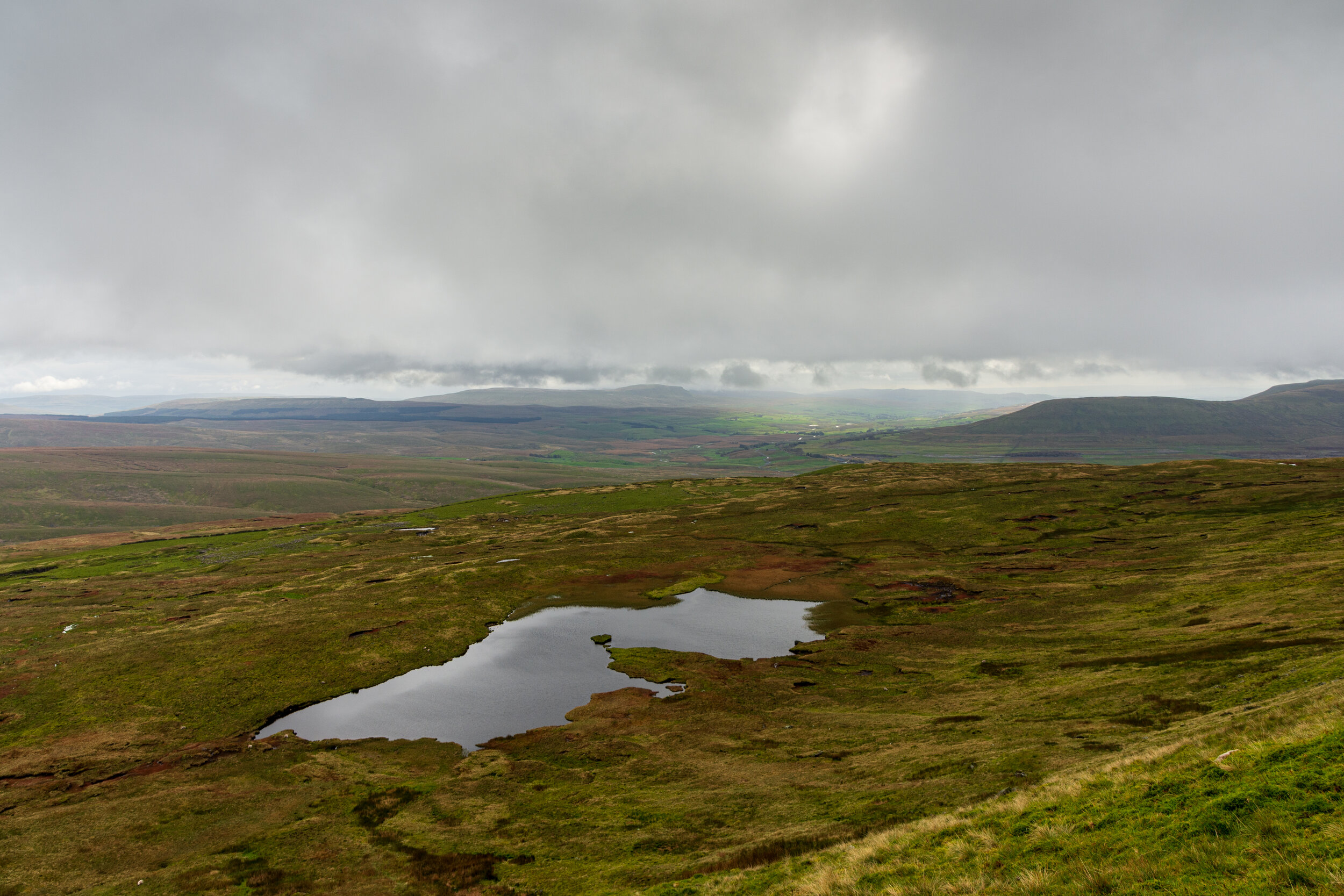
A tarn set into the eastern slope.
The Ribblehead viaduct is an impressive structure - the longest on the Settle-Carlisle line at nearly 405m long. It was completed over five years and built by a workforce of over 2300 manual labourers, who lived in the camps below the viaduct and on the slopes of Blea Moor, the remains of which are still visible today. Mortality rates were high, with over 100 workers and family members losing their lives, their bodies buried in the cemetery at Chapel-le-Dale.

The Ribblehead viaduct with Whernside as a backdrop
I’d avoid the main Yorkshire Three Peaks paths on Whernside at the weekend in the summer months if possible, as it is pretty busy with folks on the Y3P challenge - you’ll often find that the climb up to Whernside is where people start to struggle - after the enthusiasm of Pen-y-Ghent, and the long slog over the moors, the relentless climb, tackled at speed, can tire unprepared legs!
The border between Yorkshire and Cumbria splits the ridge in two, with the trig point ‘registered’ on the Cumbrian side. The trig point itself is slightly off the path, and through a rather narrow pass in the wall - easily missed if you’re powering through, and there aren’t people there already.
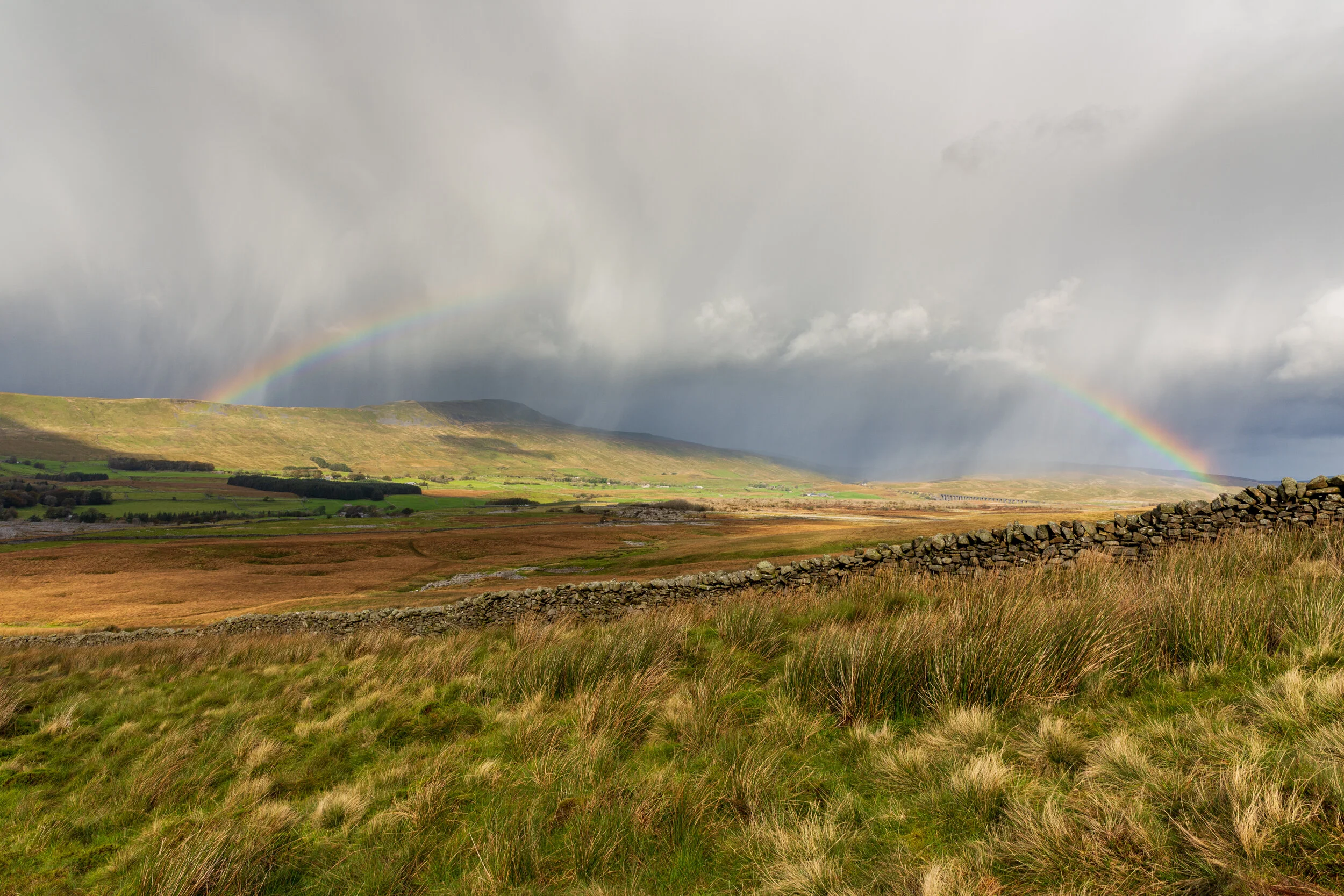
I’m not really sure why, but Ribblehead is full of meteorlogical drama
The views from the ridge are impressive - to the north and east, the hills appear wild and untamed - indeed a drive past the Ribblehead viaduct circles the neighbouring Blea Moor, and leads to one of the more remote parts of the Dales. I’ve never actually managed to tackle Whernside on a completely clear day, however this is certainly not a regret - the unique weather patterns passing through the valley between the neighbouring Ingleborough and Whernside can lead to some stunning vistas and impressive cloudbursts.
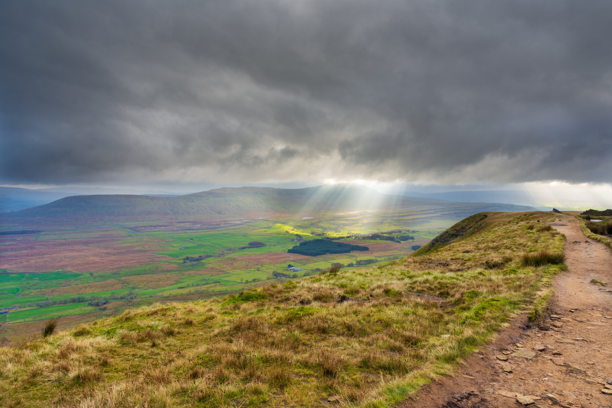
Cloudburst over Ingleborough, viewed from the Whernside ridge