Scafell Pike from Great Langdale
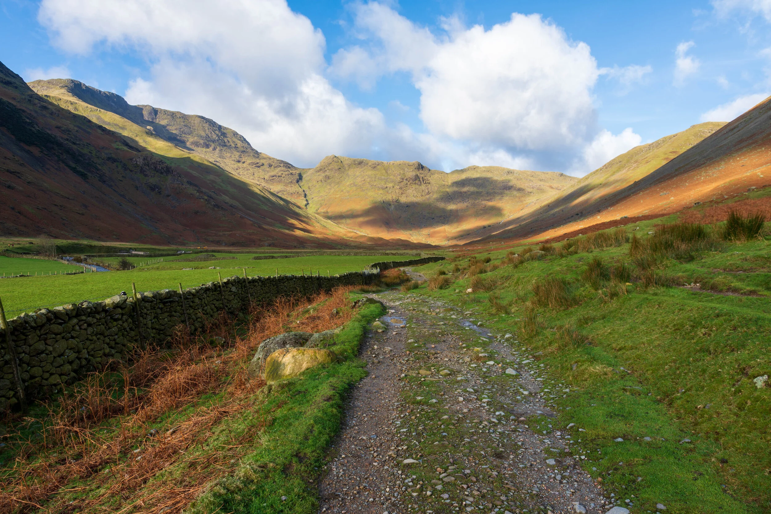
Into the valley…
A fantastic walk starting in my favourite Lake District valley, taking in the highest mountain in England, plus two of its cousins along the way.
Start and finish: Old Dungeon Ghyll Hotel NY 286 061
Distance: 19km (12 miles)
Rating: Tough
Highest point: Scafell Pike, 978m
Difficulty and hazards: tough - a lot of rocky ground once you pass Esk Hause - the pass from Great End to Broad Crag is particularly rocky. No serious scrambling required though you may want to use your hands a little on the final ascent to Scafell Pike.
Parking: Paid Parking available at Old Dungeon Ghyll, but gets busy in peak season
Refreshments: Old Dungeon Ghyll at start/finish. Nothing at all en route.
Accommodation: National Trust campsite nearby. Accommodation at Old Dungeon Ghyll. Within 30 minutes drive of Ambleside, Coniston and Eskdale.
Allow: 8 hours
Map Coverage: OS Explorer OL6 (get it here)
I’ve ascended Scafell Pike three times, and this loop from Great Langdale is perhaps my favourite.
I'd never been to Great Langdale before (or so I thought - I'd actually skirted around the edge earlier in the year when walking from Grasmere), and it seemed intriguing.
The route follows Mickleden Beck, then up Rossett Pike, past Great End, before crossing onto Scafell Pike. Then, back again, before circling around the horseshoe, up Esk Pike, then Bowfell, and back down into Great Langdale.
I parked near the Great Langdale hotel. There were a few people about, but it was largely quiet. I set off into the valley, and immediately connected with the place. Walking into a fairly large and long valley, with no road, mountains towering on both sides, and the knowledge that the only way out was up to the mountains felt epic. I frequently stopped to take photos to try to capture the scale of the experience, and I passed the very distinguishable and scree-sloped Langdale Pikes on my right.
The path was largely well marked and well trodden, a bit boggy in places, but not too bad. I came across a signpost, set against the end of the valley, signalling my choices. Basically up one mountain to the Stake Pass, or up another mountain to Esk Hause.
Epic.
I followed the path to my left across the beck, which started to asend steeply now. I stopped occasionally to take in the views of the valley which spread out before me. After working hard for what seemed like an age, I reached a small scramble near the top, and eventually crossed the brow of the slope, where the ground evened out a little.

Looking back down the lush Great Langdale - the Langdale Pikes towering above the left side of the valley
I followed the path and came across a Angle Tarn, just nestled there in the mountains. The summit of Bowfell towered up the side of the tarn, I looked at the steep rocky slopes with a mixture of excitement and trepidation.
After passing to the right of the tarn, and crossing a stream, the path now started to ascend again - not as steeply as before, but certainly steadily. To my right, I was treated to quite an expansive view across Tongue Head, and as the path steepened, Thirlmere came into view.
The ground flattened out again, and I came to a very obvious cross road. Straight on, and I would descend to Sprinkling Tarn, before eventually onto Styhead Tarn and Green and Great Gable. Left to right, the path runs from Scafell Pike before circling the valley around Seathwaite.
I turned left here, and then took a path to the right at Esk Hause. I passed Great End to my right and saw Scafell Pike before me.
There were a few people around, but I could see quite a lot of people scrambling up to the Scafell Pike summit in the distance. The summit doesn’t seem too far away, but it’s still actually some distance from here.
I crossed some very difficult rocky terrain over Broad Crag. I could now see the path down the crag and up Scafell Pike. I descended the crag carefully, and found myself on a narrow pass with steep scree drops to both sides.
It became clear that I'd lost quite a lot of height, and the path up to Scafell Pike suddenly looked a lot more imposing. There were a lot of people on the path up, making their way slowly, so I buckled up and started the ascent.
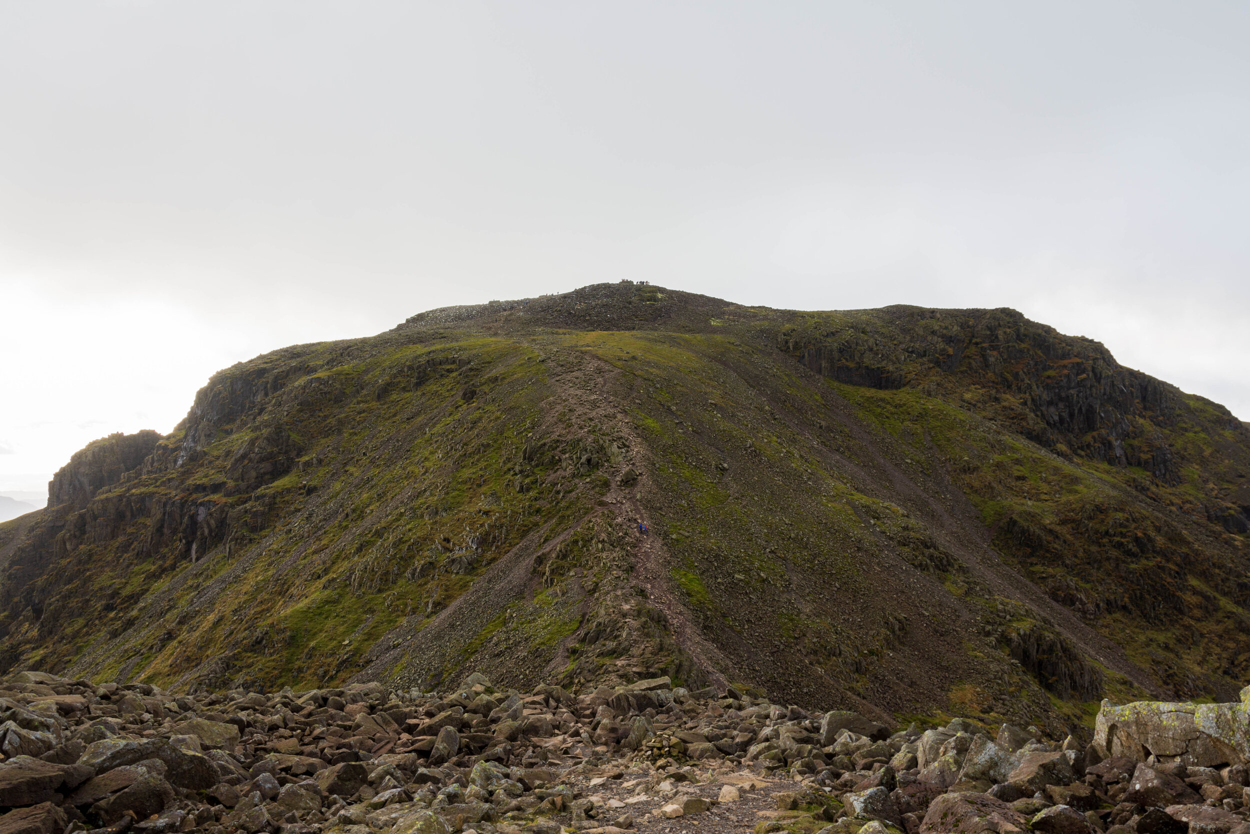
The final push to the summit of Scafell Pike, from Broad Crag
It’s a steep path from here to the summit, but it’s quite a broad slope and the odd hand here and there helps steady against the threat of drop on the left side. The path flattened out, and it was a case of navigating another well-polished rock field to the shelter at the summit.
The cloud had moved in so the views weren’t as epic as I’d have liked. With a lot of people around, I stayed for a short time, before heading back down the same slope.
I headed back up Broad Crag, and across the rock field. I noticed that the area to my left, at the top of Ill Crag was empty. Ill Crag isn’t really celebrated in any way - it’s a large plateau, with an unmarked summit at the end, but not one of the Wainwrights, so is often ignored. I headed across the rocks and to the edge of the crag, where I was treated to a magnificent view of the valley below, and Morcambe Bay in the distance. I then looked to Scafell Pike to my right - it was crowded with people at the summit. Where I stood was 935m in height and completely deserted. It amazed me what a different experience you got from just 40m difference.

The view from the largely-overlooked Ill Crag. Definitely worth a 30 minute detour.
I then headed back to the path. I considered breifly heading up Great End, but with little daylight now left, I decided against it. This was my one regret of the walk - I looked back 10 minutes later and noticed a couple who were in front of me and decided to go up Great End had already reached the summit, and were on their way down. I could have fitted it in. Never mind.
My next target was Esk Pike. As I approached the summit, the ground became rocky again.

The view across to the Langdale Pikes, from near Esk Pike
Next was Bowfell - again this was a little rocky, but I got incredible views back down Great Langdale. The air was cold now, and the sun was low in the sky, so I didn't stay too long.

The rocky summit of Bow Fell
I followed the steep, rocky path down Bowfell and passed below 700m for the first time in hours, eventually reaching a fork in the path. I chose to head right along the ridge between Mickleden and Oxendale, as the sun started to set. The path seemed to stretch forever, and my knees were starting to tire, but eventually I descended into Great Langdale. Dusk had descended before I returned to the car, but the last 1/2 mile was flat and easy.