Buckden Pike and Great Whernside (no relation)
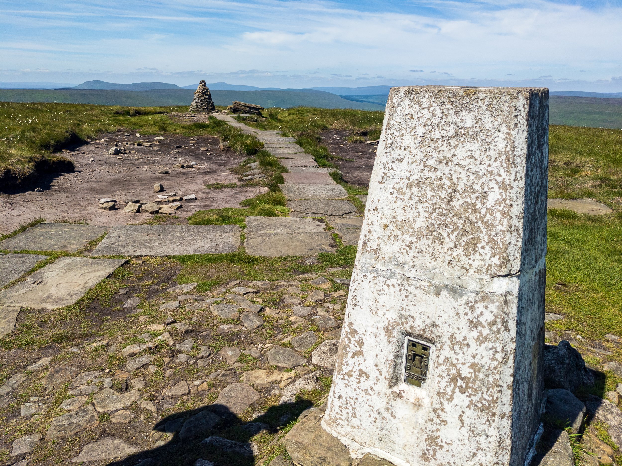
Looking at the Yorkshire Three Peaks from the summit of Buckden Pike
One of my favourite places in the Dales - at the head of the famously accessible Wharfedale, this walk is far from the usual hustle and bustle, at the top of the beautiful dale.
Start and finish: Buckden YDNPA car park, SD 942 774
Distance: 22km / 14 miles
Ascent rating: 742m, Intense
Highest Point: Great Whernside, 704m
Difficulty and hazards: Paths around Tor Mere Top are sketchy, and ground can get very boggy, otherwise good paths throughout.
Travel: Yorkshire Dales National Park Authority car park in Buckden. This isn’t huge, but there is further parking in Kettlewell if you’re happy to have a different start point.
Refreshments: During peak season, there are pubs in Kettlewell, Starbottom and Buckden, with shops and toilets in Kettlewell and Buckden. Nothing at all once you are up in the hills.
Accommodation: B&Bs and inns available in Kettlewell, Starbottom and Buckden. Campsite in Kettlewell and limited camping/pods at Heber Farm near Buckden.
Having received my new North Dales OS map (OL30 in case you were wondering) through the post a few days earlier, I set about excitedly planning a walk in an area I hadn't explored before. After looking over the map, I was drawn towards Buckden Pike, a substantial peak near the head of Wharfedale.
Buckden Pike, despite being inside the top 10 highest peaks in the Yorkshire Dales, is surprisingly accessible, and gives views which, in my opinion, are amongst the best you’ll get in the National Park. Great Whenside, although a little taller, feels a lot more ‘hill like’, but has a slight ‘other-worldly feel. Finally, there is a gentle, yet stunningly beautiful return along the River Wharfe in a lush, verdant valley.
Starting in the Yorkshire Dales Authority car park in Buckden, the weather was gloriously sunny for September, and I headed immediately up the bridleway along the dale and up the side of the pike.
The head of Wharfedale, looking out from the path up to Buckden Pike
The way at this point was signposted and I took a footpath into a field, which continued to ascend, heading up towards the summit. The ground under foot was fairly good - a little boggy in places, but not too challenging. I was treated to expansive views of Wharfedale, bathed in sunlight. The path continued to climb and I came to a gate which separated the large, green pastures with open moorland. The path up to the summit was clear in front of me (although I could not see the summit itself at this point). I couldn’t help but look back into the lucious valley behind me, and eventually Whernside came into view, folowed by Pen-y-Ghent and Ingleborough. To my left I could see out across the North Dales.

The more famous Yorkshire Three Peaks of (L-R) Pen-y-Ghent, Ingleborough and Whernside
The climb was never overly challenging, and I made mental note that this was probably going to be a good walk for my then 5-year old. After the last steep climb, I could see the summit before me. The views from here were quite spectacular, with several summits in the Dales in view, and even see Scafell and Scafell Pike, 50 miles away in the Lake District, were visible in the distance.

I see Lakeland! Scafell and Scafell Pike in the distance
I took in the views for a few minutes, and then headed along the path across the plateau.It was at this point that I noticed my back was pretty wet. With the conditions, I was wearing quick-dry shorts and a merino t-shirt (it was a testament to the fab weather that I never needed to use my other packed layers), but even so, I couldn't just dismiss it as sweat. I stopped just off the path to investigate.
Disaster! The bottom of the bag was very wet, and my spare hat, gloves and socks were sodden. The water pouch in the bag had developed a pinhole leak (at the bottom), and water had been leaking into the bag. The pouch had lost about half a litre of water, with about a litre still remaining. I drank quarter of a litre of the remaining water, and put the pouch into a plastic bag, before wringing out the wet equipment, and drying the bottom of the bag. I repacked, and continued the walk.
The ground became progressively more boggy on the plateau, though certainly not challenging at this point. I reached a Polish war memorial, and stopped for a moment to take in the scene.
On 30th January 1942, a Wellington Bomber carrying six Polish airmen got lost in a snowstorm. Briefly making out the lights of town below (which unknown to them was Skipton), they circled around and unwittingly flew into the Dales. Flying too low, it clipped a wall on Buckden Pike and then careered into the plateau. Four of the crew were killed on impact. Jospeh Fusniak, the rear gunner, had a broken ankle, and went to get help. With no visibility on the moor, he stumbled around before fortuitously coming across some fox tracks in the snow, which he followed until they disappeared. Almost giving up hope, the clouds broke briefly enough to make out Starbottom in the valley below, and after shouting for help, rescuers found Joe. Unfortunately the other crash survivor had died of his injuries by the time they returned to the wreckage, making Joe the sole survivor of the tragedy.
After taking in the memorial, I consulted the map, as my route would soon deviate from the path taken by most of the other hikers who would head down Buckden Pike towards Starbottom. I could see Great Whernside a couple of miles in front of me, atop of a long ridge across open moorland. Aside from a small road running along the bottom of the fell, and the odd shaped Little Whernside to the left, the moorland was largely featureless. The path would largely follow a wall across the moor.
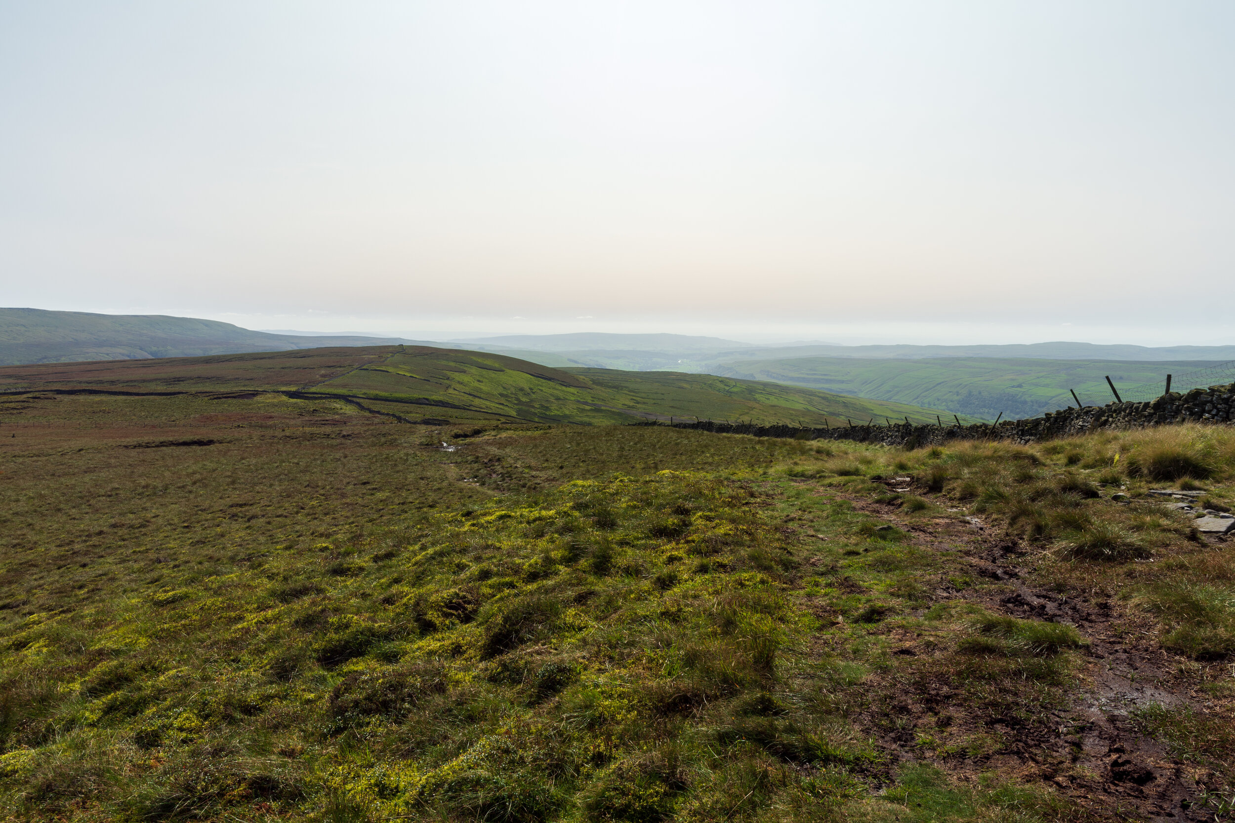
A very empty and boggy moor! Great Whernside on the left.
I continured along the path, which became increasingly boggy and difficult. I reached a stile where the main path to Starbottom crossed over a wall to my right. The path before me, across to moorland, was barely visible, and as continued to follow it, conditions became extremely boggy significantly slowing my progress. The path at this point faded away, but I continued to navigate with the wall in sight (though not following it now to avoid the worst of the boggy areas. The moor descended gently, and I took the opportunity on reaching a relatively dry piece of ground to stop and put my lunch somewhere accessible.
I also wanted to check on the water pouch sitution. I had been drinking the water at an increased rate since discovering the leak. Now, there was just under half a litre left. I decided that the best course of action now would be to drink all of the remaining water to ensure I was hydrated for Great Whernside. After that summit, my route took me into the village of Kettlewell, which I had driven through earlier, so I knew there was a shop where I could buy a drink.
I felt a lot better after draining the water pouch - I no longer needed to worry about my pack getting wet. I put the pouch and the wet equipment into the plastic bag, and repacked. I made another mental note to bring three plastic bags next time - one for stuff that got wet, one for stuff I wanted to keep dry, and one for rubbish.
I continued slowly as I ate my lunch. The moor was still very boggy, but I was now fairly good at finding a route through. The moor climbed slightly up to Tor Mere Top, and once I'd reached this summit, I could see the wall in front of me, dropping off to the left, down the fell. The map defined the path along the wall and down the hill as a bridleway, and indeed it was better defined than the path I had just been on.
With the descent relatively gentle, and the ground a little firmer, I made good progress down the hill. It was interesting as I descended how the perspective of Great Whernside changed - from the top of the moor, it had looked that I had to traverse a steep valley to get to the ridge, now I could see the entire path to Great Whernside, I could see that the valley was quite shallow.
I eventually reached the road in the valley, and crossed this. I noticed the sign 'Welcome to Richmondshire' on the side of the road. Great Whernside was signposted, and I headed off to my next waypoint.
The ground became quite boggy again - never quite a difficult as the top of the moor - but still enough to slow my progress. Eventually as the path climbed steeply up the side of the fell, the ground firmed up. I powered up the steep path, before passing through a gate onto open moorland on the side of the hill.
At this point, I could see a rock formation up in front of me, and then another rocky summit - the Great Whernside trig point - was to the right of that. I followed the path as it gently traversed the moor, passing the first rocky summit. I passed this and continued on to the trig point.

The rocky summit of Great Whernside (no relation to its namesake in the background!)
I found the views on Great Whernside to not be quite as spectacular as those from Buckden Pike. I could still see the Yorkshire Three Peaks in the background, and the Lake District in the background. However, to the east were the North York Moors - effectively I could see the Lake District to the west, which borders the Irish Sea, and the North York Moors to the east, which neighboured the North Sea. It’s not so often you can see across the width of the country.
Next, I descended down a steep path from the summit, towards Kettlewell. The path soon became a more gentle descent, again across some boggy moorland, but easily navigable due to several posts marking the path. I eventually came to a craggy drop at Hag Dyke, and followed the path down this, and passing the farmhouse to my right, onto a small road. I followed the signpost for the footpath back to Kettlewell. This was a pleasant walk along the top of Dowber Gill, and occasionally looking behind me, I was surprised by how picturesque Great Whernside looked from this angle. It certainly looked a lot less bleak than the path I had ascended earlier.
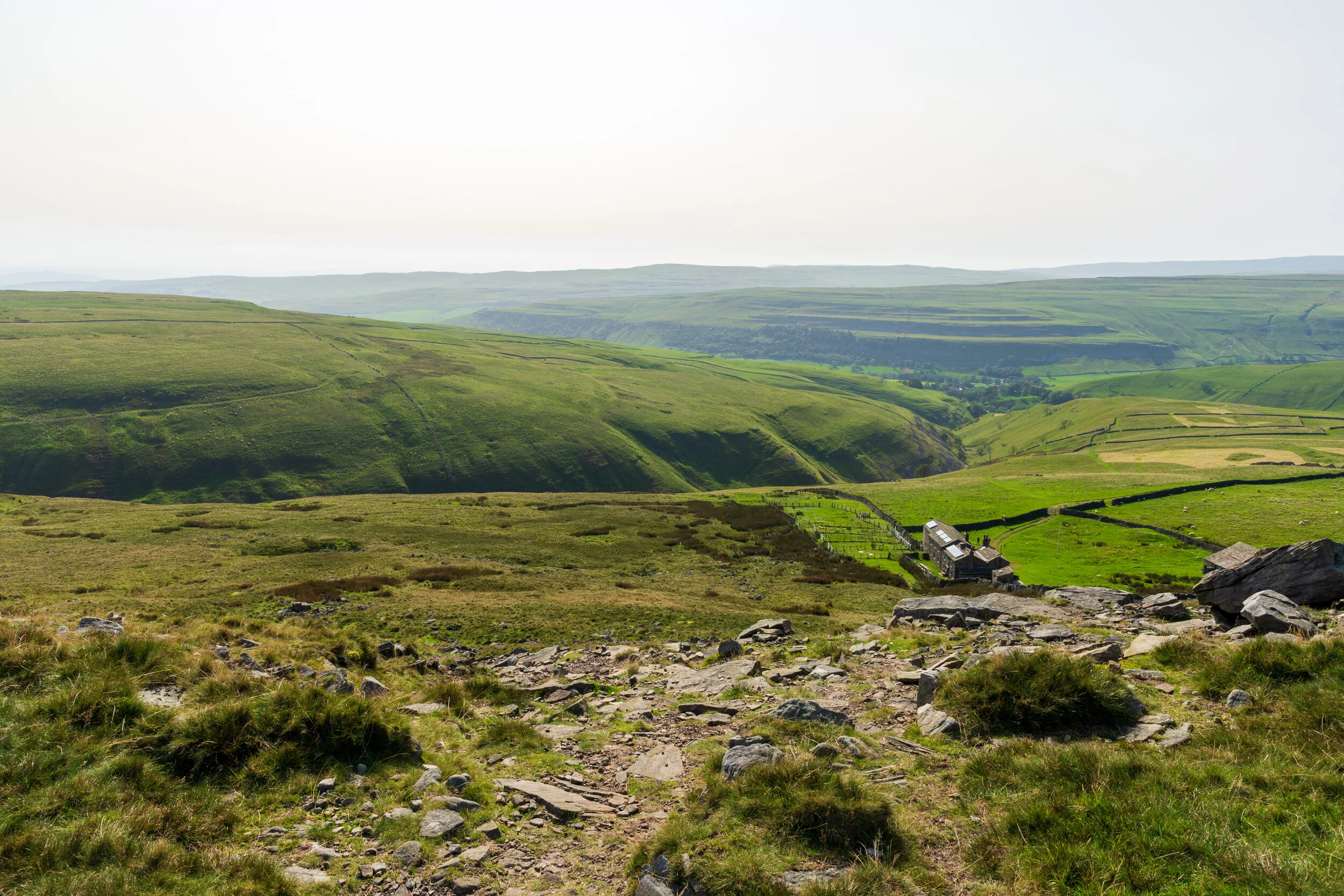
The velvety slopes of Dowber Gill, looking down from the crags of Hag Dyke
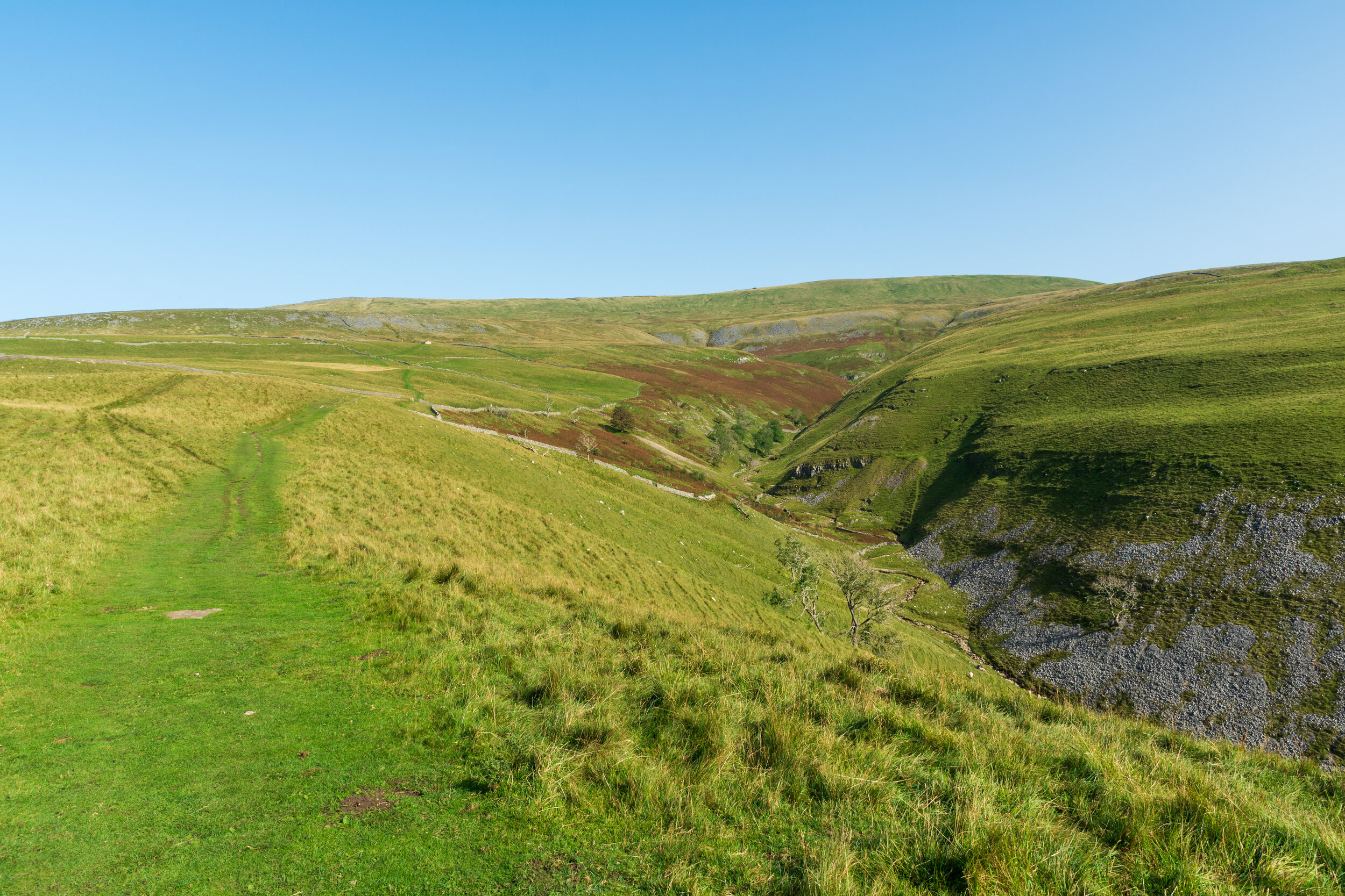
Dowber Gill looks fascinating - I made a mental note to come back and explore
After passing through a coupe of fields as a I reached the valley, I crossed a stream and was on a small road. I followed this through the outskirts of Kettlewell, eventually ending up near the centre. I stopped at the car park cafe to pick up a much-needed drink, and then crossed the bridge across the River Wharfe.
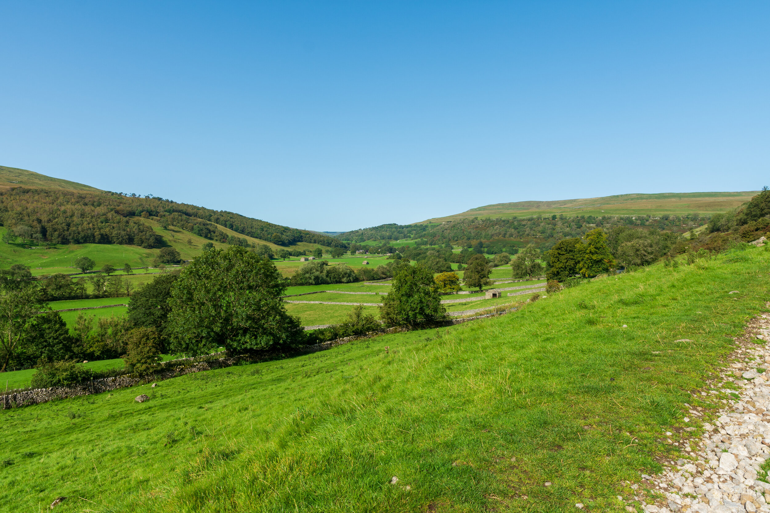
The next part of my journey I hadn't been looking forward to - it was a 4 mile walk along the river, on the Dales Way, back to Buckden. The path was a fair bit busier than I was used to, with many people parking up and enjoying the scenery. Still, the walk was surprisingly enjoyable - the valley was beautiful, and the river was calm. The path quietened considerably after Starbottom, and I strolled the last couple of miles, my legs now tiring, returning to an almost empty car park as the sun started to set over the valley.
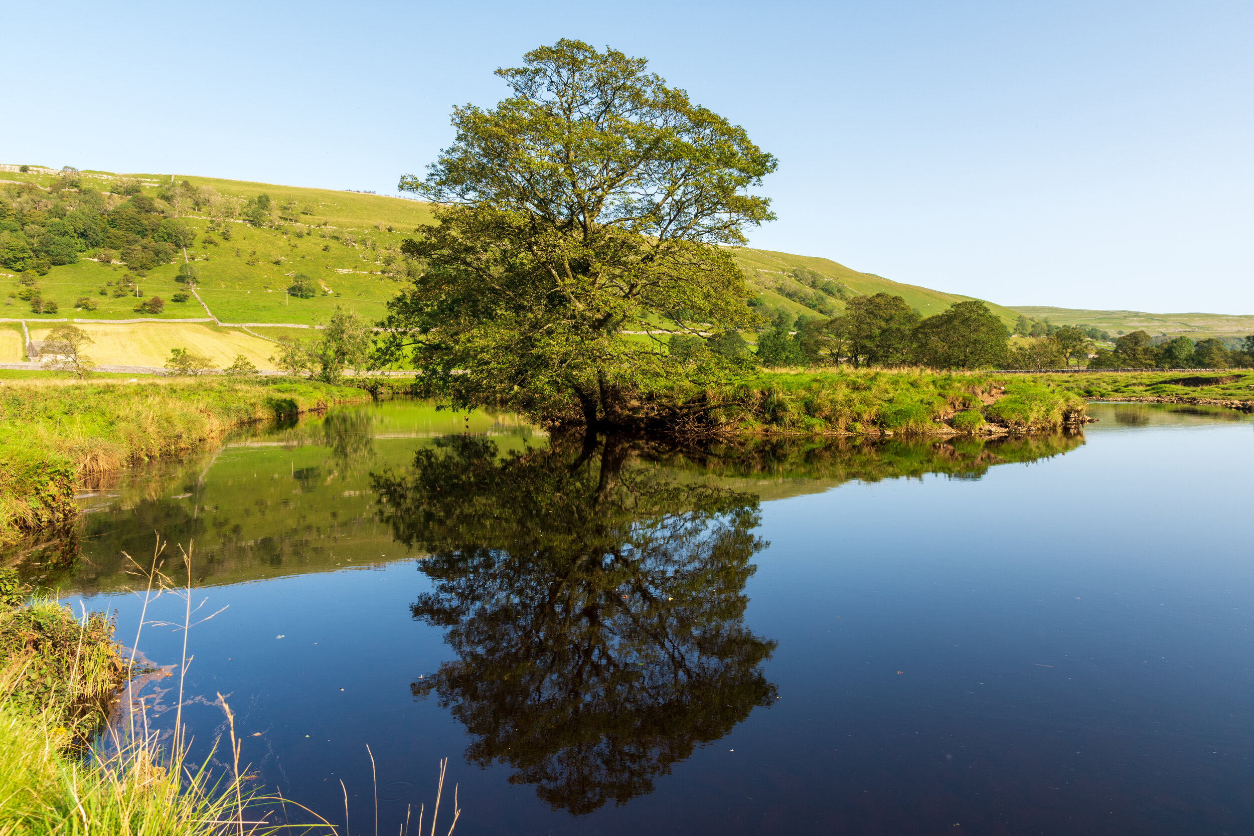
The riverside walk back to Buckden is stunningly beautiful