Pen-y-Ghent

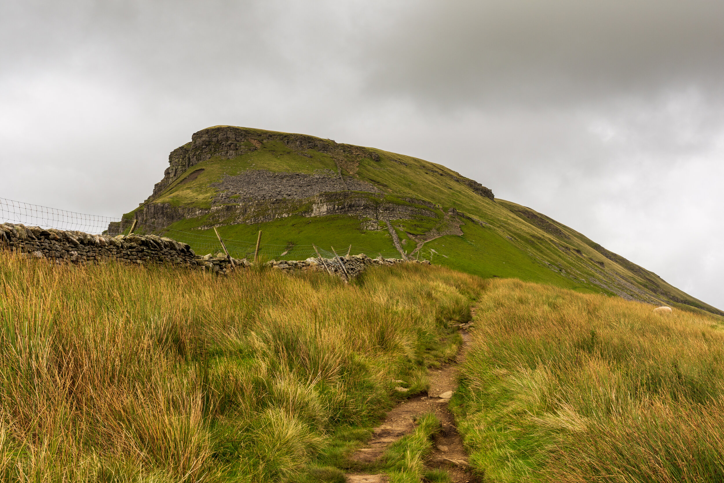
The ‘crouching lion’
Location (summit): SD 839 734
Getting there: The vast majority of people will approach along the Yorkshire Three Peaks route from Horton-in-Ribblesdale, where there is a lot of parking provision and a train station (on the Settle-Carlisle line). As an alternative, there are some laybys on the road between Stainforth and Halton Gill, on the eastern side of the mountain.
Height (marked by trig point on summit): 694m
Prominence: 306m
Map: OL2 (Yorkshire Dales Southern & Western Areas)
Most famous as one of the Yorkshire Three Peaks, this mini-mountain contains plenty of fun in its own right, either as a challenging, yet short adventure with the kids, or for longer expeditions involving the remote, yet enchanting Pen-y-Ghent Gill to the east, or the seldom-visited Plover Hill to the north.
An unsual name which makes one think more of the Welsh mountains rather than Yorkshire Dales, the name is likely derived from the Celtic dialect of Old Cumbrian, which shares with Welsh the ancestor language of Common Brittonic. The name is likely to mean ‘Hill on the Border’.
So, let’s get it out of the way now. Pen-y-Ghent is the first peak on the famous Yorkshire Three Peaks walk, if leaving from the traditional starting point of Horton-in-Ribblesdale. On any given day, and especially in the summer, if you visit Pen-y-Ghent early in the morning, you’ll be one of scores of walkers navigating the Y3P path to the summit. Most people at this point are full of energy and enthusiasm, and as such many will charge to the summit without exploring the hill, and be off the hill again before even thinking about breakfast (a brisk walking time on the Y3P will usually see you at the summit within an hour of starting).
Should the weather be decent, what everyone on this route does experience however is fantasitc views to the east, and an invigorating and exposed (yet largely safe and straight-forward) mini-scramble to the plateau.

The summit of Pen-y-Ghent on a rather wet day
The summit offers views towards Fountains Fell to the south east, and the other two of the Yorkshire Three Peaks to the west. The land to the north and east feel somewhat remote, and particularly enticing if you feel the need to get off the beaten track.
The most common route to the summit is along the Yorkshire Three Peaks path from Horton-in-Ribblesdale. This ascends to join the Pennine Way, before tackling the mini-scramble to the plateau and summit. If you want to avoid the crowds, try heading off a little later in the day - by this time most of the challenge walkers will have already passed through, leaving a quiet mountain to explore.
From here, most people will continue to follow the Pennine Way off the summit, crossing the wall (and the passing the shelter built within it),either branching off further down to follow the Y3P path to the north, or continuing on the Pennine Way to complete a short circuit back to Horton-in-Ribblesdale.

The view most Y3P walkers will be greeted with early on in the walk
Alternatively, if you head immediately right after crossing the wall, the significantly quieter path will take you along the long slope of the plateau, and ultimately to the subsidiary peak of Plover Hill. From there, you can drop onto Foxup Moor, and turn left, to explore the western side of Pen-y-Ghent as you return to Horton-in-Ribblesdale, or right, to explore the eastern side, towards Foxup and Pen-y-Ghent gill.
Geologically speaking, Pen-y-Ghent is similar to several other hills in the region, with layers of millstone grit capping off limestone. More uniquely, Pen-y-Ghent acts as the watershed between water flowing off its western slope, into the Irish Sea, and water flowing off its eastern slope, into the North Sea. This has likely contributed to its unique shape, and features, with plentiful caves and pot holes, such as Hull Pot and Hunt Pot, The rakes and stunning gritstone features, such as the Pen-y-Ghent Pinnacle on the southern and eastern slopes were exposed in a huge thunderstorm in 1881, which washed away the top soil, exposing the rock underneath.
The impressive mountain-like rakes, exposed when an 1881 thunderstorm washed away the top soil
Hull Pot, just off the Y3P path, is the largest natural hole in England, measuring 60ft wide, 60ft deep and 300ft across. It is all that remains of a vast, collapsed underground cavern, which would have been some sight.
Personally, I feel that the best way to get an appreciation of the mountain is to explore Pen-y-Ghent Gill to the east. The remote gill is home to several caves, waterfalls and spectacular landscape, with fantastic views of the more seldom-seen easter slope of Pen-y-Ghent once you ascend out of the gill. Combine the gill with a circular walk taking in Pen-y-Ghent, Plover Hill and Foxup for a great day out.

Pen-y-Ghent from the quieter eastern side


