Ilkley Moor (Rombalds Moor)
The view from Rombalds Moor near Ilkley, out to Otley Chevin
Location: SE 115 452
Getting there: Several options from the Northern (Ilkley) side - the most accessible is from the car park at the Cow & Calf rocks. Multiple lay-bys and parking areas along the road to Burley Woodhead, plus further parking in Ilkley. From the south, the approach is longer, but some limited parking on the road to the south of the moor, or for a longer route, you can approach from Baildon.
Height (at highest of two trig points): 402m
Prominence: 244m
Map: OS Explorer 297 Lower Wharfedale & Washburn Valley)
Well-known due to its accessibility from nearby Leeds and Bradford, legend in song, and a plethora of ancient sites, Rombalds Moor offers the first real taste of remoteness when approaching the Yorkshire Dales from Leeds to the east, despite this being historically one of the most intensely-utilised areas of moorland in the region.

The view of Ilkley below Rombalds Moor
Many refer to the entire patch of moorland as ‘Ilkley Moor’ - in reality, this is Rombalds Moor, made up of a number of smaller moors, including Ilkley Moor, Addingham Moor, Morton Moor, Bingley Moor, Hawksworth Moor and Burley Moor.

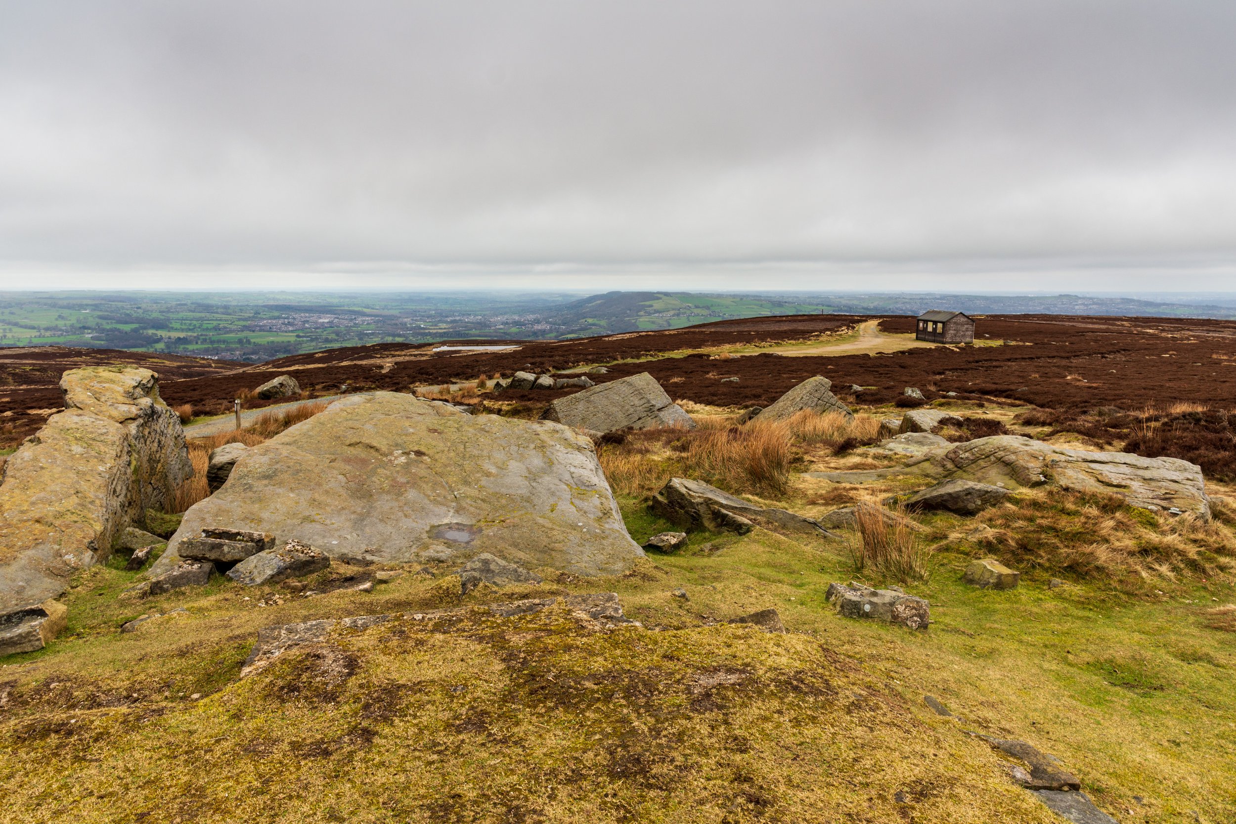
The ‘summit’ of Rombalds Moor near Ilkley
The entirety of Rombalds Moor is vaster than you might think - you could easily make a full day out of exploring all the corners of the moor, and visiting all the sights on offer.
Many will be introduced to the moor from the Cow and Calf rocks, near the pub of the same name. The gritstone crags (made of Addingham Edge grit, similar to millstone grit), offer several scrambling opportunities, and views across Lower Wharfedale, across to Otley Chevin, Almscliff Crag, into the Vale of York, and on a clear day, even beyond to the North York Moors.
Although perhaps the most famous, a number of other crags exist along the same edge, and also dot the rest of the moor.
Beware if you’re heading on to ‘Ilkley Moor bar t’hat’, - its prominence, sandwiched between Airedale and Wharfedale usually make the exposed moor windy, and the ground contains large areas of peat bogs. Luckily, a number of substantial paths exist across the moor, connecting most of the key areas of interest, with a number of smaller sheep-tracks-cum-worn-paths criss-crossing the moor.
The moor was covered in woodland at the end of the last ice age, and this was removed during the Bronze Age as farming communities transformed the land first for crop growing, then for livestock grazing. During this time, a number of ‘Cup and Ring Marks’ appeared on rocks - these carvings remain something of a mystery, but are still visible today.
Perhaps the most famous site on the moor is the Twelve Apostles stone circle. Although it is likely that this is the original site of the stone circle, and some of the stones originally formed it, what you see today is unlikely to be representative of the original site. It’s likely that the site contained originally around 20 stones, and all the ones visible today have been re-erected in the past 100 years, making it impossible to ascertain the original purpose of the site. Still, it is a good, accessible introduction to locating archaeological sites on the moors.
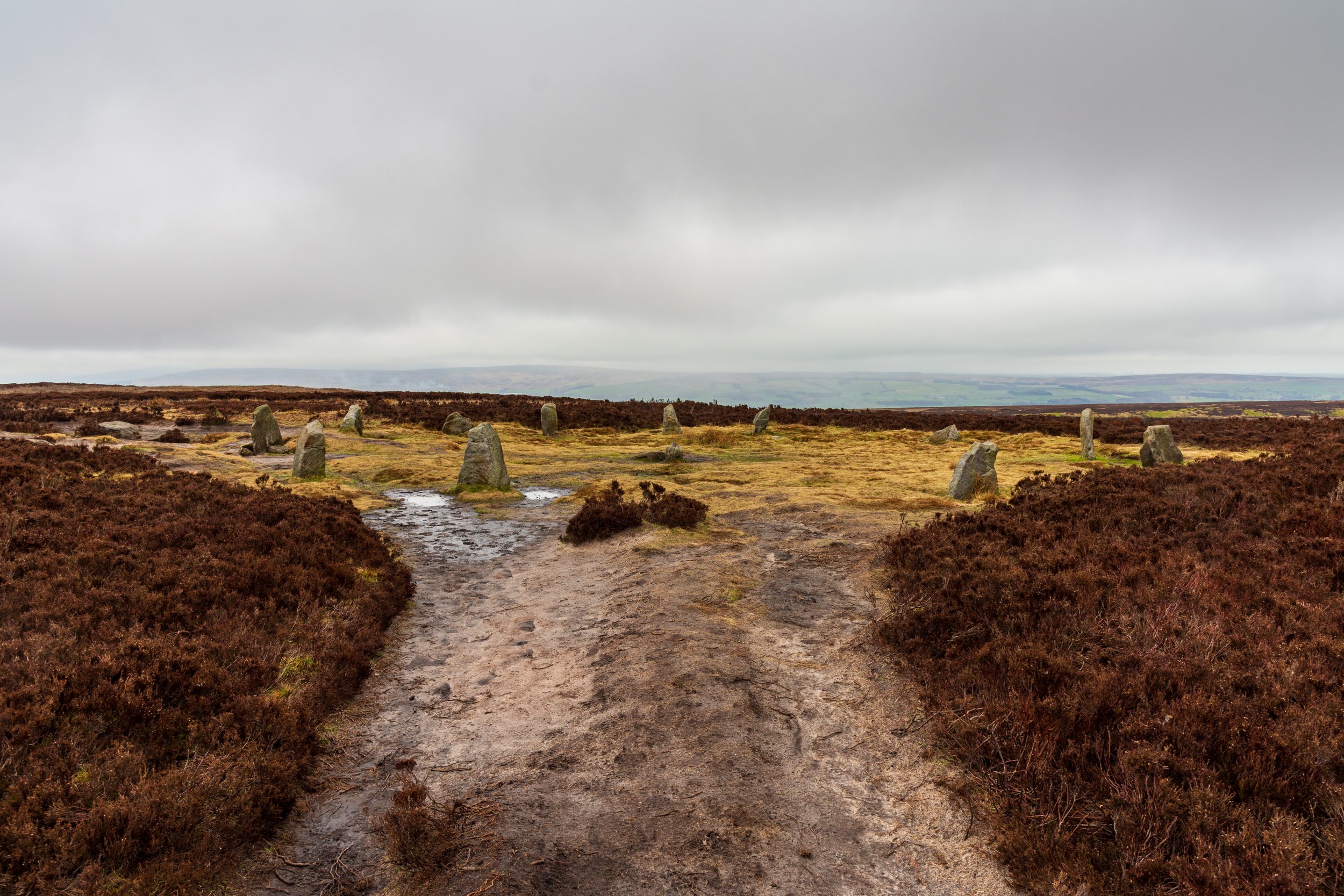
The Twelve Apostles on Rombalds Moor / Ilkley Moor
A number of other sites of interesting human activity exist on the moor. Three small reservoirs line the eastern side of the moor, with Ilkley Tarn on the far north end, near the town. There’s also the famous ‘Swastika stone’, plus a couple of stone tablets, containing a poem, near the trig point.

The stone tablets on Romblads Moor near Ilkley
Most recently (and still until this day), the moor has been carefully managed for grouse shooting, which has largely shaped the heather landscape that you can see. In early spring, smoke will billow across the moors from controlled burning of heather, and you’re unlikely to venture far from the path without spotting grouse in the undergrowth - special care should be taken not to disturb any nests, and stick to the paths between March and September.
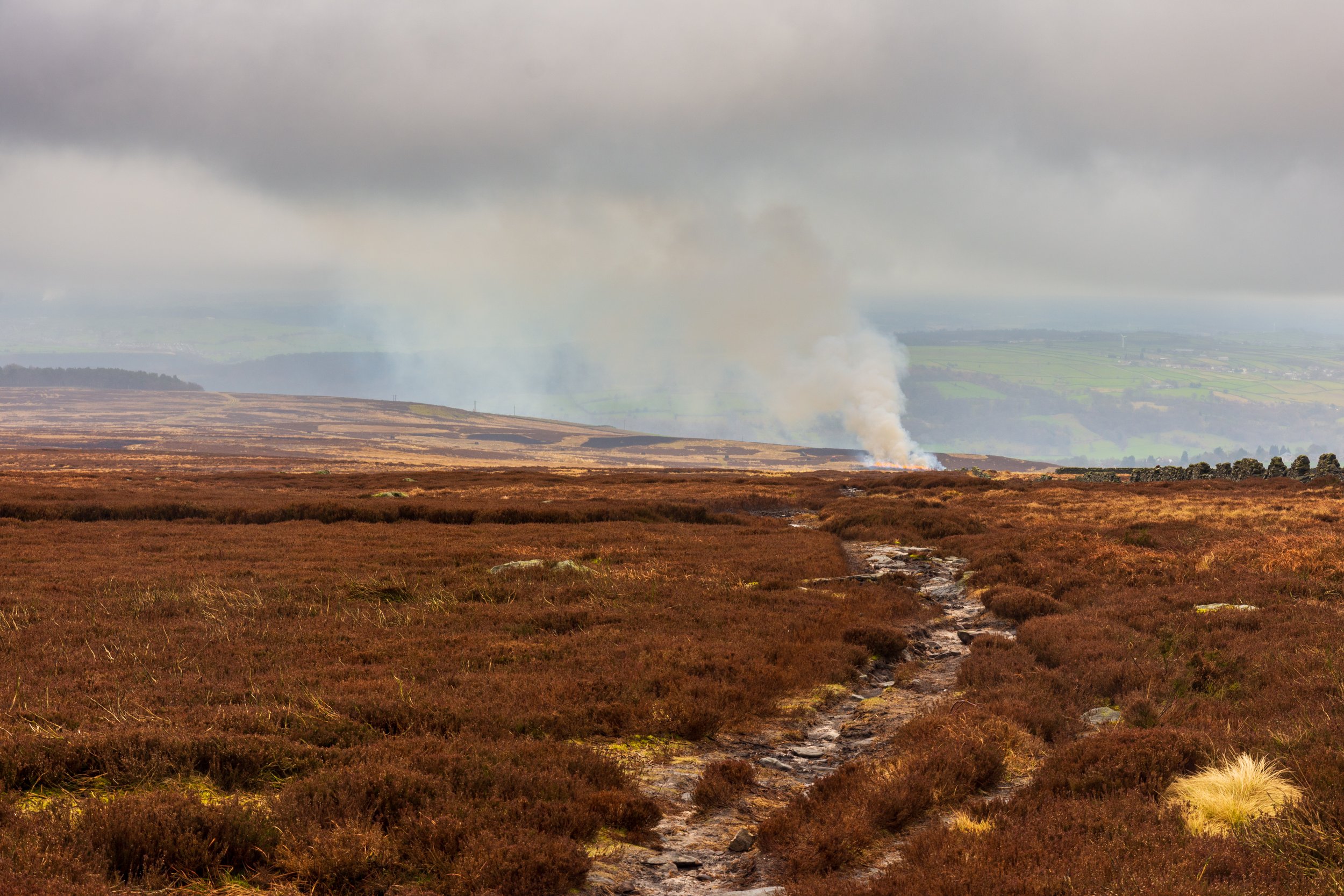
‘Controlled burning’ of the heather on Rombalds Moor to encourage new growth for feeding the grouse
A number of other birds also nest on the moor, including the much-hunted hen harrier, curlews and lapwings, and I’ve seen a lizard cross my path on more than one occasion.
Routes are plentiful, but one of my favourites is to start at the lesser-explored Barks Crag on the far eastern side, before checking out Lower Lanshaw reservoir, the views from the crags near the High Lanshaw Dam, before heading across the Twelve Apostles, the trig point and wireless station at Whetstone Gate, before following the track down to Spicey Gill, crossing the valley, and following the northern edge all the way back.
On another day, it’s also well-worth exploring the northern slopes around White Wells, and for those looking for a mega-walk, start at Saltaire, and head to the moor via Baildon Hill, before crossing to Bingley, then heading back along the canal.


