Meugher

The odd lump-shaped Meugher, viewed from the west
Location (summit): SE 044 704
Getting there:
Remote location so significant trek is required. Can approach from Wharfedale to the west (parking in Conistone/Kettlewell) or Nidderdale to the east (limited parking in Middlesmoor and Lofthouse), Scar House Reservoir to the north or Grimwith reservoir to the south (parking at both reservoirs).
Height (at trig point on summit): 575m
Prominence: 36m
Map: OS Explorer Map OL2 (Yorkshire Dales south) and/or OL30 (Yorkshire Dales north), depending on route taken
Meugher’s charm lies in its remoteness. On days where the honey pots of the Dales can turn a hike into a procession, you’re likely to see very few - if any - pilgrims to this oddity, which lies close to England’s furthest location from a public road, and just outside of the Yorkshire Dales National Park, within the Nidderdale AONB.
Once you become acquainted with it, the little bump is obviously visible from several other larger and more famous summits. In return the views from the summit are impressive, with Great Whernside, Simon’s Seat, Cracoe Fell, Kirby Fell and even Pendle Hill visible, beyond the vast, empty, expansive moorland surrounding you on all sides. You can also see across the vale of York, with Drax Power Station on the skyline in the distance.
There is remarkably very little on the hill, other than a trig point on the summit, and weather station, just to the south.
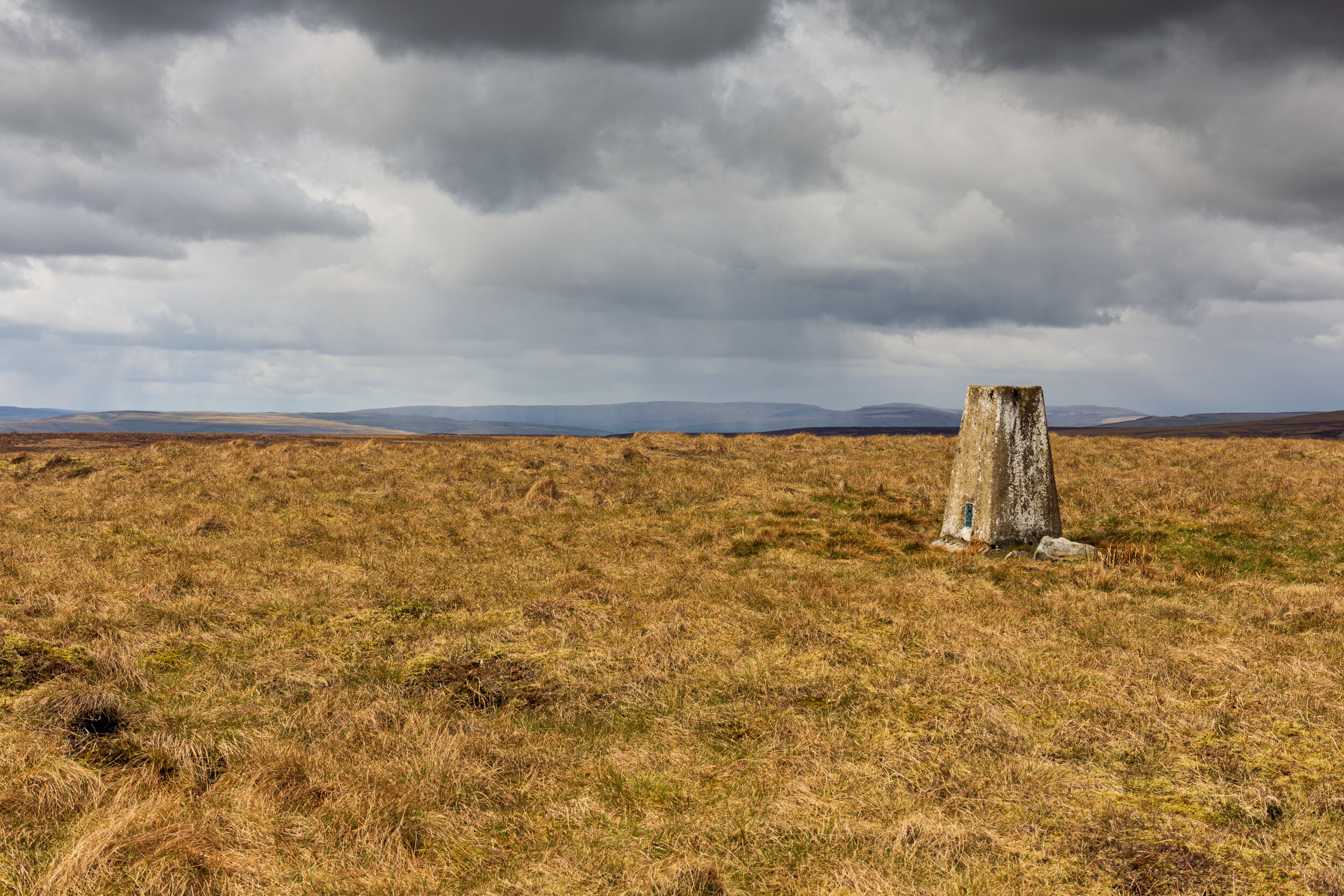
The lonely Trig Point on the summit of Meugher
A pilgrimage to the summit can however be combined with several other interesting features nearby. Approach from Wharfedale, there’s the opportunity to ascend Conistone Dib and visit Mossdale Caverns, before a potentially boggy off-path route through the peat hags to the summit.
To the east is Nidderdale, with the magnificent How Stean Gorge. From here, you can head north, and the path will take you to the north of Meugher, leaving you with a short, off-path climb to the summit. The simplest route (as long as you can reach the access land) from Stean is a hunter’s track, which takes you right up to the peak, and from there you can follow a green mat path almost to the summit.
I’d also take the opportunity to explore the area to the east of the summit - there is an interesting route from Nidderdale (no path but easily navigable) through Great Scar and Acoras Scar, and also several craggy outcrops.

Waterfall at the head of Acoras Scar


