Rogan’s Seat

The summit cairn of Rogan’s Seat
Location: NY 918 032
Getting there: Approach via Swinner Gill from Muker or Keld in Upper Swaledale, with alternative approach from Gunnerside via Gunnerside Gill
Height (at Trig Point on summit): 672m
Prominence: 195m
Map: OS Explorer OL30 (Yorkshire Dales - Northern & Central Areas
Standing as the 17th highest peak in the Yorkshire Dales, Rogan's Seat may not be the most well-known summit in the national park, but its remoteness and open moors mean you’ll barely see another soul all day.
Rogan's Seat is the northernmost ‘mountain’ of the Yorkshire Dales, sitting 5km north of the already-remote Swaledale. Its summit stis atop a vast, empty moor, and is marked by a small cairn (though a trig point lies a kilometre to the north).
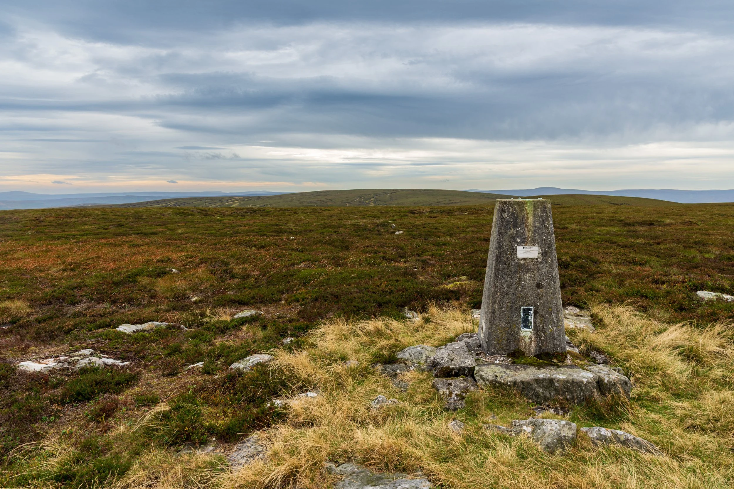
The Trig Point on Rogan’s Seat, with the actual summit approx 1km in the background, looking back into the Yorkshire Dales. Whernside can just be seen on the left.
One thing that is very noticeable from the summit it how different the views are to the rest of the Yorkshire Dales - familiar peaks such as Ingleborough and Whernside lie to the south, but some distance away, whereas to the north, the giants of North Penines dominate the skyline.
Just who Rogan is remains a mystery - the name likely has a Norse origin, and has endured for 1000 years. The ‘Seat’ part of the name denotes an ‘upland pasture’ rather than somewhere that someone ruled over!
The moor is still managed for grouse shooting, with vehicle tracks, grouse butts and shooting boxes all present on a summit otherwise charcterised by peat hags. The easiest approaches to the summit make use of these tracks - following paths up either Swinner Gill or Gunnerside Gill to join them to the summit.
Both Gills are well-worth exploring on your trip - Swinner Gill contains a number of spectacular waterfalls and plunge pools (note: Take the path on the right of the gill on the ascent to avoid climbing the waterfalls!), and Gunnerside Gill is the site of a large former lead-mining operation, with many building ruins still present.
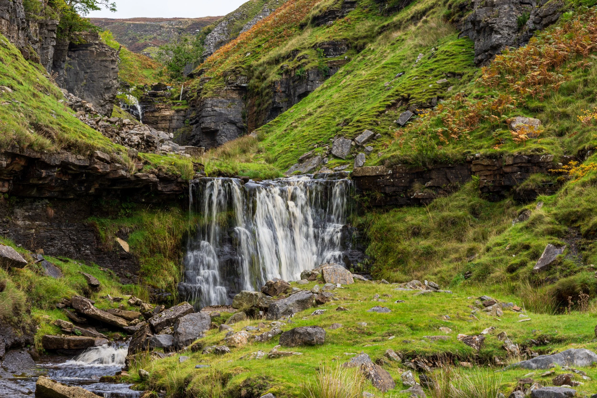
A waterfall in Swinner Gill, on the ascent to Rogan’s Seat. You may be better off taking the path up and on the right!
My personal favourite route would be to start at Muker and to head north through the valley towards Keld, diverting right onto the steep path that follows Swinner Gill. On reaching the Swinner Gill Lead Mines ruins, you can either take the easy (longer) option to the east, before turning right onto the track to the summit, or alternatively, continue off-track, up the gill, before joining a solid vehicle track further up.
From the summit, the trig point is not the easiest to reach - I wouldn’t even attempt to get to the trig point, unless you know how to navigate!
For Gunnerside Gill, from the summit, there is some off-path navigation to reach the Blakethwaite Dames, and then a decent path as you descend to Gunnerside, before a lovely riverside path through Swaledale, back to Muker.
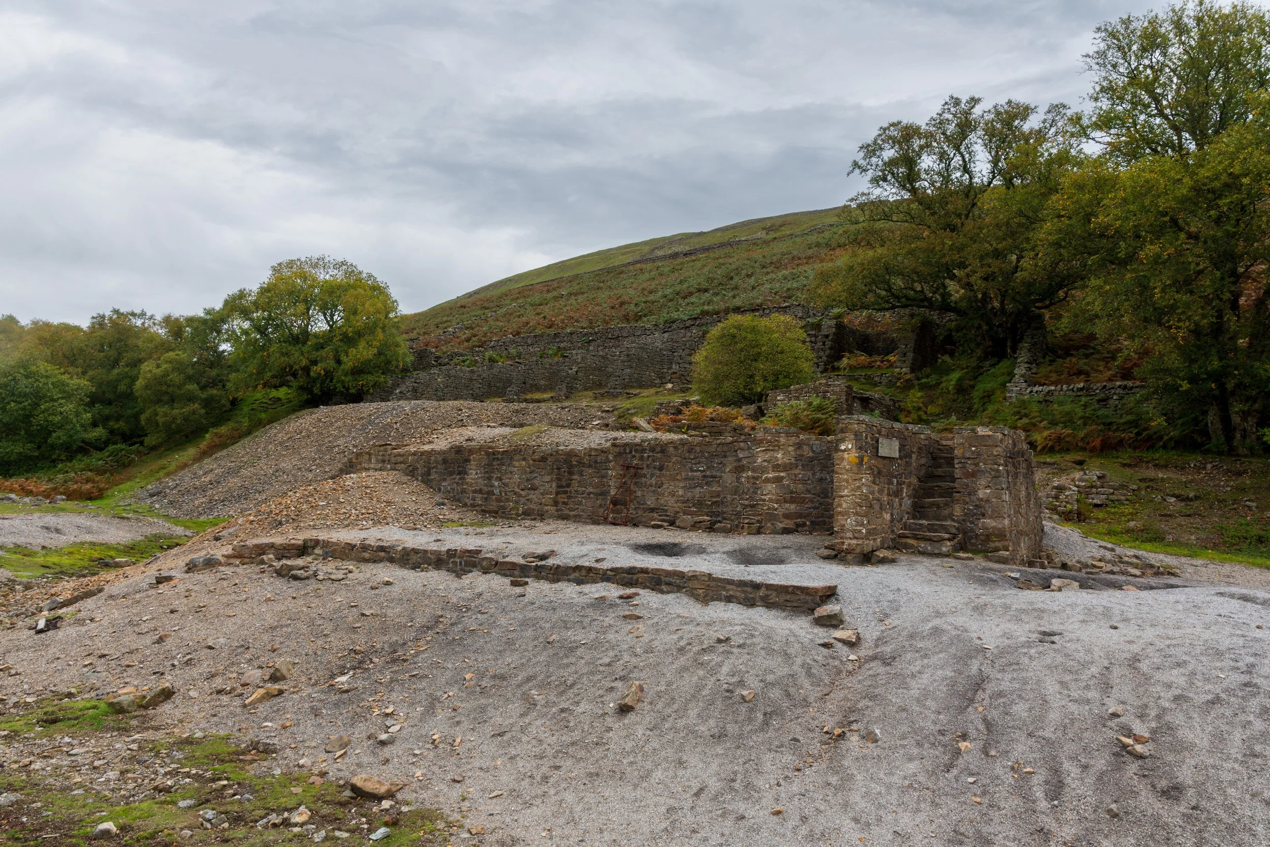
Some of the mine workings in Gunnerside Gill, on the return from Rogan’s Seat.