Little Whernside
The oddly-shaped Little Whernside
Location (summit): SE 028 776
Getting there: Approaches are limited and require either a long drive or long walk. Approaching from Scar House Reservoir is perhaps the most straight-forward, with a free car park near the Visitors’ Centre. For public transport, take the bus to Kettlewell, and approach via Great Whernside.
Height (marked by cairn on summit): 604m
Prominence: 78m
Map: OL30 Yorkshire Dales (Northern and Central Areas)
A distinctively-shaped peak that resembles a mini Pen-y-Ghent from some angles, Little Whernside is a remote hill that straddles the Yorkshire Dales and Nidderdale.
If Great Whernside is merely overshadowed by its more famous namesake, Little Whernside exists in almost complete obscurity. Yet despite its lack of fame, its odd shape is one of the things that draws your attention your most during the Wharfedale Three Peaks walk between Buckden Pike and Great Whernside - its ‘sleeping lion’ hump punctuating a seemingly flat and barren landscape to the north of its bigger brother.

Little Whernside, next to its bigger brother
Much like the (relatively) nearby Meugher, Little Whernside itself offers little interest for explorers of historic sites, but its beauty lies in the tranquillity of the surrounding area - both in the stunning and remote Nidd Head valley that separates the two Whernsides, and the calm waters of Angram and Scar House reservoirs, lying on its flanks.

The dam at Scar House Reservoir
The reservoirs themselves are massive feats of engineering. Scar House Reservoir in particular took 15 years to complete, and a village was purpose-built nearby to house the workers and their families. Home to 1250 people (peaking at 2000), the village was state of the art at the time, with running hot and cold water, flushing toilers and electricity, and also contained several shops, a cinema, concert hall, bank, school and post office. The village was dismantled shortly after construction.
The reservoirs were built to supply water to Bradford, and the similarly-impressive Nidd Aqueduct was built (largely underground) to transport the water along its 32-mile journey.
For most, a combined visit with Scar House Reservoir would make most sense - a short(ish circular) walk following the north shore of Scar House Resevoir, before heading towards an interesting ruined lodge that was abandoned during the construction of the reservoir in the 1920s. From there, either take the route north (anti-clockwise) or follow the bridleway east to Hard Bank, before ascending an unmarked hunters’ track to the left of the wall. Note however that the path immediately along the reservoir is closed until November 2021 - until then you can follow a track along the side of Carle Fell Side, straight to the lodge.

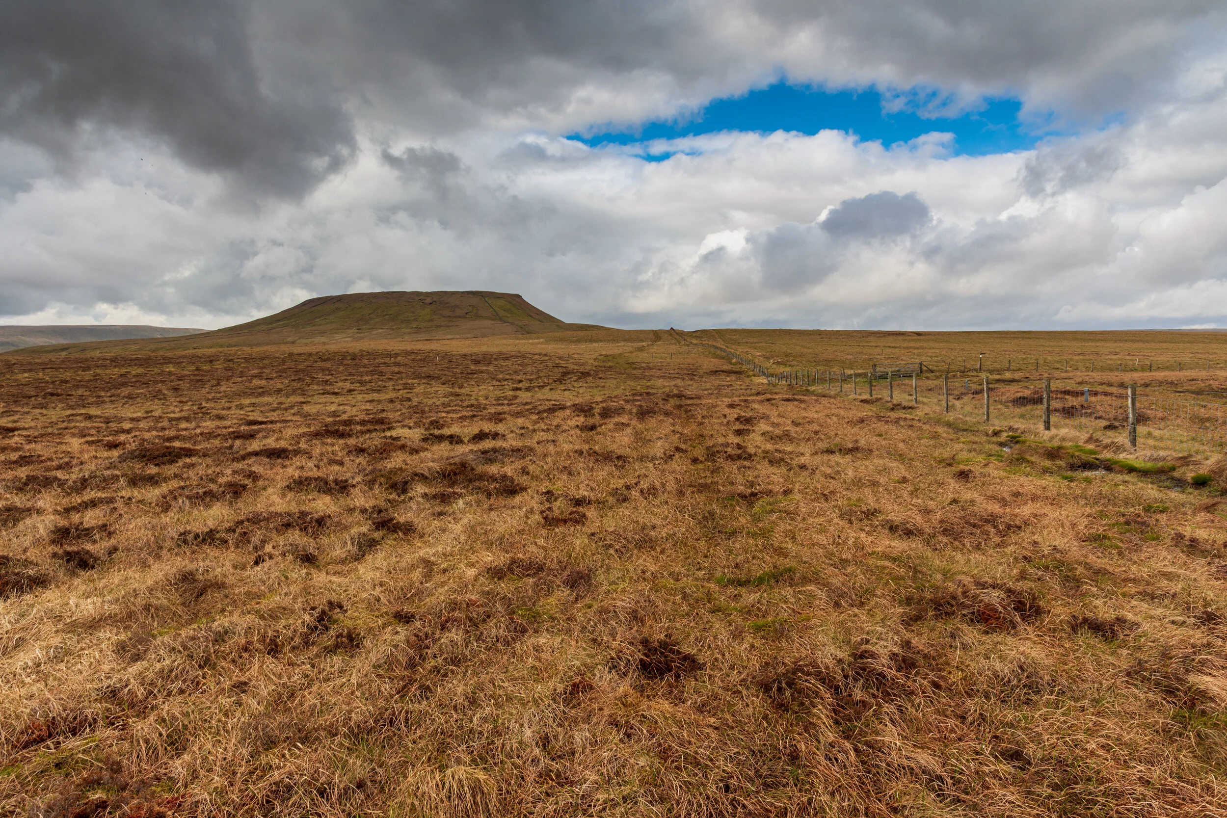
The approach to the summit, after climbing Hard Bank
For the more ambitious, you can combine with Dead Man’s Hill, Carle Fell and Great Haw - be warned however that even though this is open access land, this is grouse hunting territory, so there may be a couple of fences to negotiate.
For an even longer walk, the path between Little and Great Whernside provides a surprisingly satisfying ridge walk
The ‘summit’ is a barren affair - a fairly large, flat plateau containing a number of peat hags, some lying across the path, making route-finding more interesting. There is a cairn, however a wall separates it from the path. Continue north beyond the cairn, rather than following the path, and the sides drop steeply, with some crags making the descent into Covedale more interesting.

The peat hags on the summit