Great Knoutberry Hill

Approaching the summit of Great Knoutberry Hill from the south
Location (summit): SD 789 872
Getting there: Approach from the west via bridleway along Arten Gill, or Coal Road. There is also an approach from the south or a much longer route from Widdale to the east. No car parks in the vicinity (unless you fancy the trek from Ribblehead), but some on-road parking opportunities exist on the road from Newby Head into Dentdale. Please remember to park courteously and do not block passing places on single track roads, or turning areas.
Height (marked by trig point on summit): 672m
Prominence: 254m
Map: OL2 Yorkshire Dales (Southern and Western Area)
A remote summit at the head of Dentdale, Great Knoutberry Hill offers splendid views of the nearby Yorkshire Three Peaks, and on a clear day, a panoramic view which is basically a ‘who’s who’ of the peaks of northern England. ‘Knoutberries’ are the colloquial name for the Cloudberry, a plant and fruit that grows in abundance in Scandinavia, but is rarely found in fruit in the UK. Cloudberries are edible and can be made into a marmalade or jam, though are fairly tasteless. Although it is jokingly said that the name ‘Knoutberry’ is derived from ‘Nowtberry’ (due to the fact the berries taste of ‘nowt’, or ‘nothing’ to those outside of Yorkshire), it is more likely to be taken from ‘Knot’, a Middle-English word for ‘hill’. Interestingly, ‘Cloud’ in ‘cloudberry’ also had an alternative meaning of ‘hill’.
Great Knoutberry Hill’s remoteness does lead to some challenges - long B-road routes are unavoidable and parking is virtually non-existent, and ironically it’s probably a little easier to get to via public transport than car, with Dent Station on the Settle-Carlisle line just to the east.
It is fitting that the railway provides a lot of the character of the area. Although not matching the scale of Ribblehead viaduct near Whernside just to the south, two further feats of Victorian engineering line the bottom of the hill. Dent Viaduct crosses Fell End Gill, at the bottom of neighbouring Wold Fell, and the larger Arten Gill Viaduct crosses the gorge carved out by Artengill Beck. Both were constructed between 1869 and 1875, and were built from unfinished ‘Dent Marble’, that was mined from quarries in the area (one such quarry was actually below Dent Viaduct!)
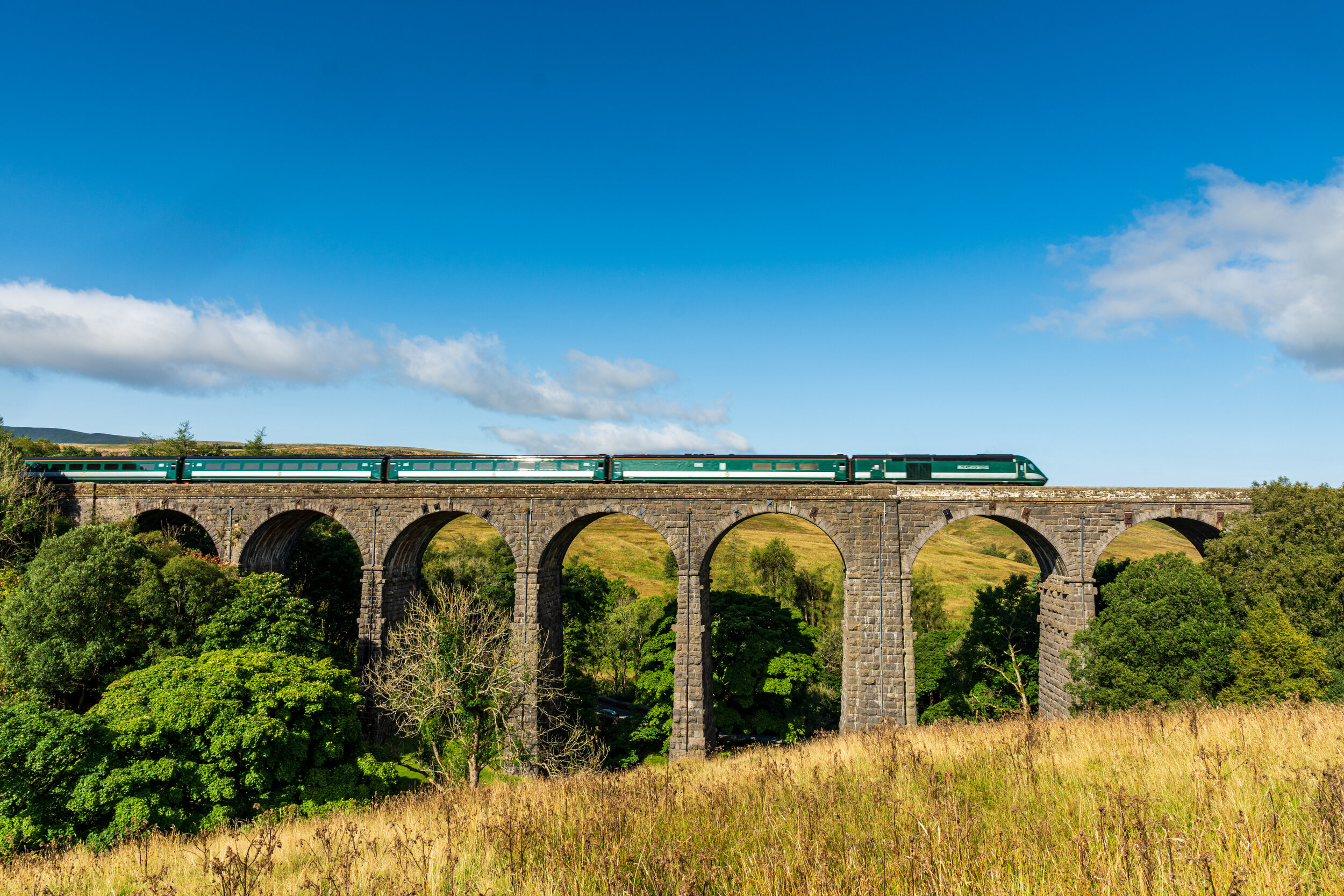
A HST returns to life with Rail Charter Services, passing over Dent Viaduct
Other than the viaducts, the remains of some of the lime kilns and a mill, most of the industrial history has vanished. Arten was the central marble works for the production of finished ‘Dent Marble’. Extracted from quarries in the region, fired in the lime kilns on the hillside, using coal produced from the pits and colliery just below the summit, and finished in the mills in Artern, powered by water from Arten Beck, the Dent Marble industry was a largely self-contained local enterprise that sold its products throughout Britain. Dent Marble was once well-sought and prized for its dark appearance, even though it was technically not marble (‘true marble’ is metamorphic limestone, Dent Marble is ‘unaltered’ limestone). Its appearance is due to its high fossil content, which creates an impressive surface when polished. As well as its use in the construction of the viaducts, Dent Marble can be found inside many of the buildings in the area. The marble works closed down in 1907 due to the import of cheaper (and better quality) Italian marble, ironically made easier by the railways that Dent marble had helped to construct. Little also remains of the coal extraction industries, other than a few spoil heaps.

The location of Cross Pits Colliery on the slopes of Great Knoutberry Hill - little remains now except the spoil heaps
To reach the summit, you need to take a faint path from the bridleway that circles the hill at around 500m, either from the south at the top of Arten Gill, or the west, passing the cairns on Pike’s Edge. The climb is well worth it on a clear day. I know ‘expansive views’ is an overused term in this knowledgebase, but the panorama from the summit is a ‘who’s who’ of the summits of northern England. From north, clockwise, you can see: Burton Fell, Mickle Fell, High Seat, Great Shunner Fell, Rogan’s Fell, Lovely Seat, Wether Fell, Dodd Fell, Buckden Pike, Great Whernside, Plover Hill, Pen-y-Ghent, Pendle Hill, Simon Fell, Ingleborough, Ward’s Stone, Whernside, Leck Fell, Crag Hill, Calf Top, The Old Man of Coniston, Rise Hill, Scafell Pike, Broad Crag, Great End, Great Gable, Green Gable, Winder, Arant Haw, Hellvelyn, Calders, Knoutberry Haw, East Baugh Fell, Hatter Fell, Swarth Fell, Wild Boar Fell and Murton Fell. Whew!

The Lakeland fells, visible from the trig point atop Great Knoutberry Hill
If the area to the south and west of the summit are all about Great Knoutberry Hill’s industrial past, the north and east are very much grouse country. Pasture and thistles make way for sedges, bilberry and heather, along with hunters’ tracks, fences and grouse butts - the signs of previously well-managed shooting estate. Three bodies of water to the north of the summit are well-worth exploring - the biggest of these, Widdale Great Tarn, is surprisingly large, and the odd sight of a grouse butt in the middle of Widdale Little Tarn, a little further on, is an interesting spectacle.

The grouse butt located in the middle of Widdale Little Tarn


