Fountains Fell

Fountains Fell, looming over Malham Tarn
Location (summit): SD 865 716
Getting there: Approach from Malham Tarn (Free National Trust car park though busy at peak times), Arncliffe, or several laybys near Dale Head on Silverdale Road to the west. Also possible to combine with Pen-y-Ghent for a longer walk.
Height (marked by cairn on summit): 668m
Prominence: 243m
Map: OL2 Yorkshire Dales (Southern and Western Area)
Sandwiched between the gorgeous Dales honeypots of Malham and Pen-y-Ghent, Fountains Fell is a peaceful peak, with rich history to complement its stunning panoramic views.
The name of Fountains Fell derives from the fact that the land used to be owned by the Cistercian Monks at Fountains Abbey, some 40km away. Fountains Abbey was maintained by wool sold from the sheep that grazed on the land it owned. Several areas of land were granted to the Abbey in the 12th century - the area of Fountains Fell, Malham Moor and Malham Tarn were granted by William de Percy, and wool was transported to the Abbey via the impressive former Roman Road along Mastiles Lane.

Fountains Fell viewed from the slopes of Pen-y-Ghent to the west
In the early 19th century, the summit of Fountains Fell hosted a substantial colliery operation. Coal was mined using several deep shafts which are still present today, used primarily as a fuel for processing calamine for the growing zinc industry in Malham. A coke oven was added soon after, to provide coke for lead smelting. Production declined throughout the century, before ceasing in around 1860. The coke oven remains standing today.
The coke oven near the summit of Fountains Fell, dating back to the early 19th century
Beyond the rich human history, there are plenty of interesting natural features. A limestone pavement extends from the lower slopes of Fountains Fell towards Malham Tarn. Fountains Fell also has its own water feature: Fountains Tarn, which although isn’t nearly as spectacular as its nearby counterpart, is a tranquil location with fab views towards Great Whernside and Little Whernside in the distance.

Fountains Tarn on Fountains Fell, with Great Whernside and Little Whernside in the distance
But in terms of nearby summits, it is Pen-y-Ghent that looms large over Fountains Fell, with spectacular views of the peak and the valley below. The steep, northern and western flanks of Fountains Fell descend into a quiet, beautiful valley, created by Pen-y-Ghent Gill, containing a number of caves. However this side of the hill offers no formal routes to the summit, until you reach the Pennine Way, just south of Dale Head. It is the Pennine Way also that provides the most accessible route from the south and east, with a long, but well-defined track winding up the hill from Malham Tarn. The Pennine Way does not go all the way to the summit, however a decent track leads off from a set of ancient cairns along the path, through the coal mine workings, and to the top.
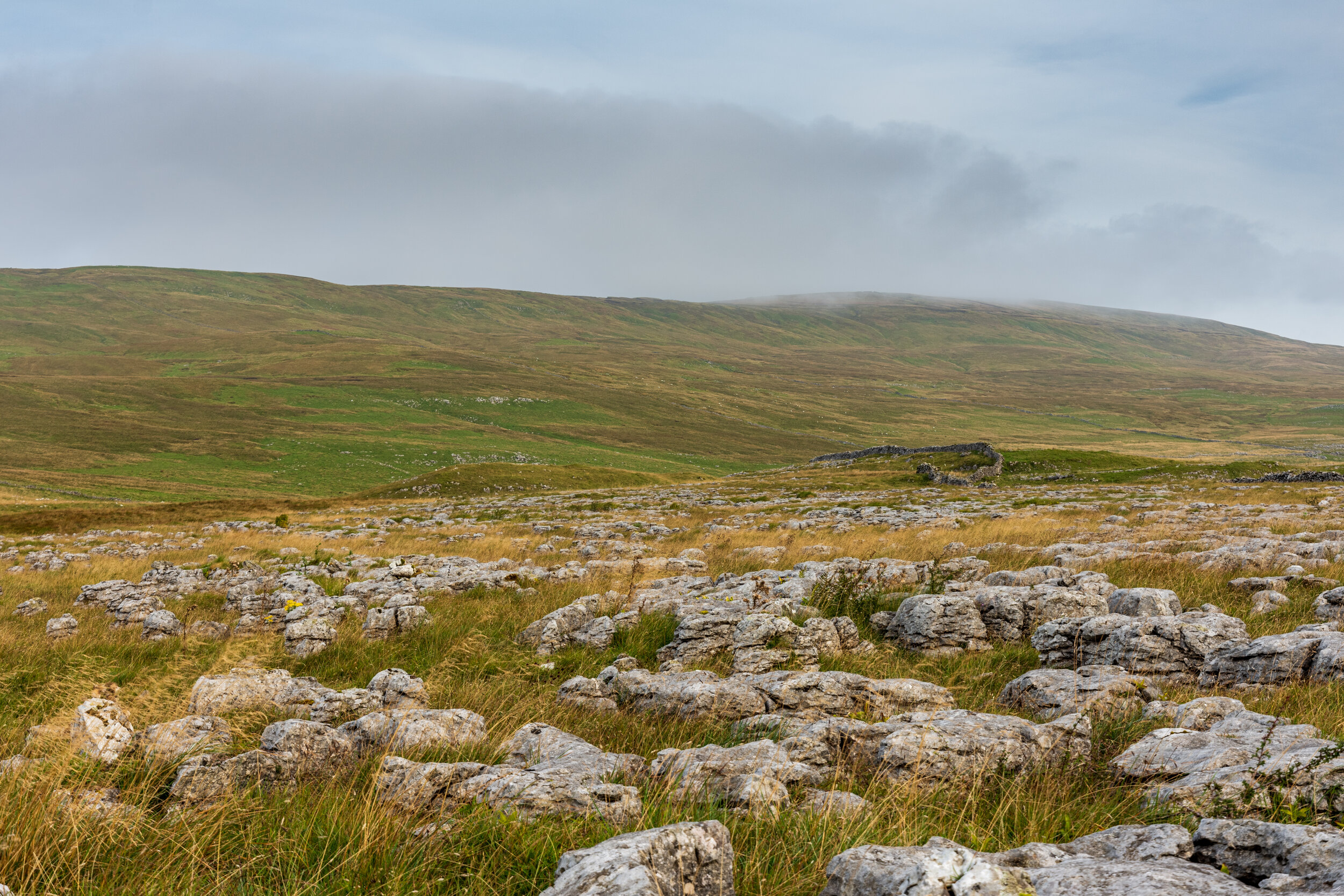
The limestone pavement on the lower slopes of Fountains Fell
If you’re feeling more adventurous, it is well worth approaching from off the path. A remote trig point exists about 3km to the south, and serves as a good waypoint if approaching from the south, though you may need to find a decent place to cross a couple of fence and wallls. This route will take you to two subsidiary summits - the first at 610m, although little more than a hump on the ridge, having the claim to fame of being the southern-most peak of 2000ft+ in the Yorkshire Dales. The second, at 662m and lying just south of the main summit is far more substantial, and it is from here that you can explore a couple more features before getting to the summit.
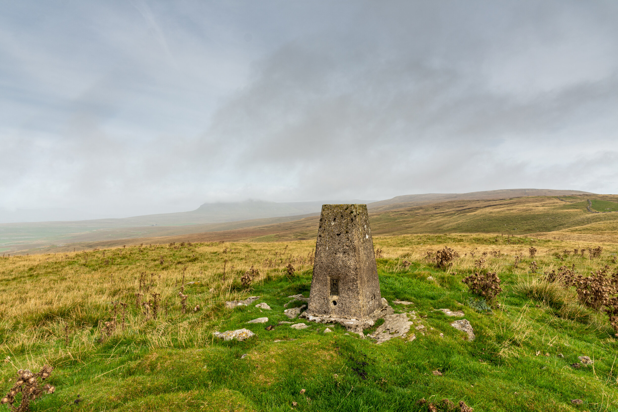
The trig point 3km south of the summit, Fountains Fell is on the right, Pen-y-Ghent is on the left
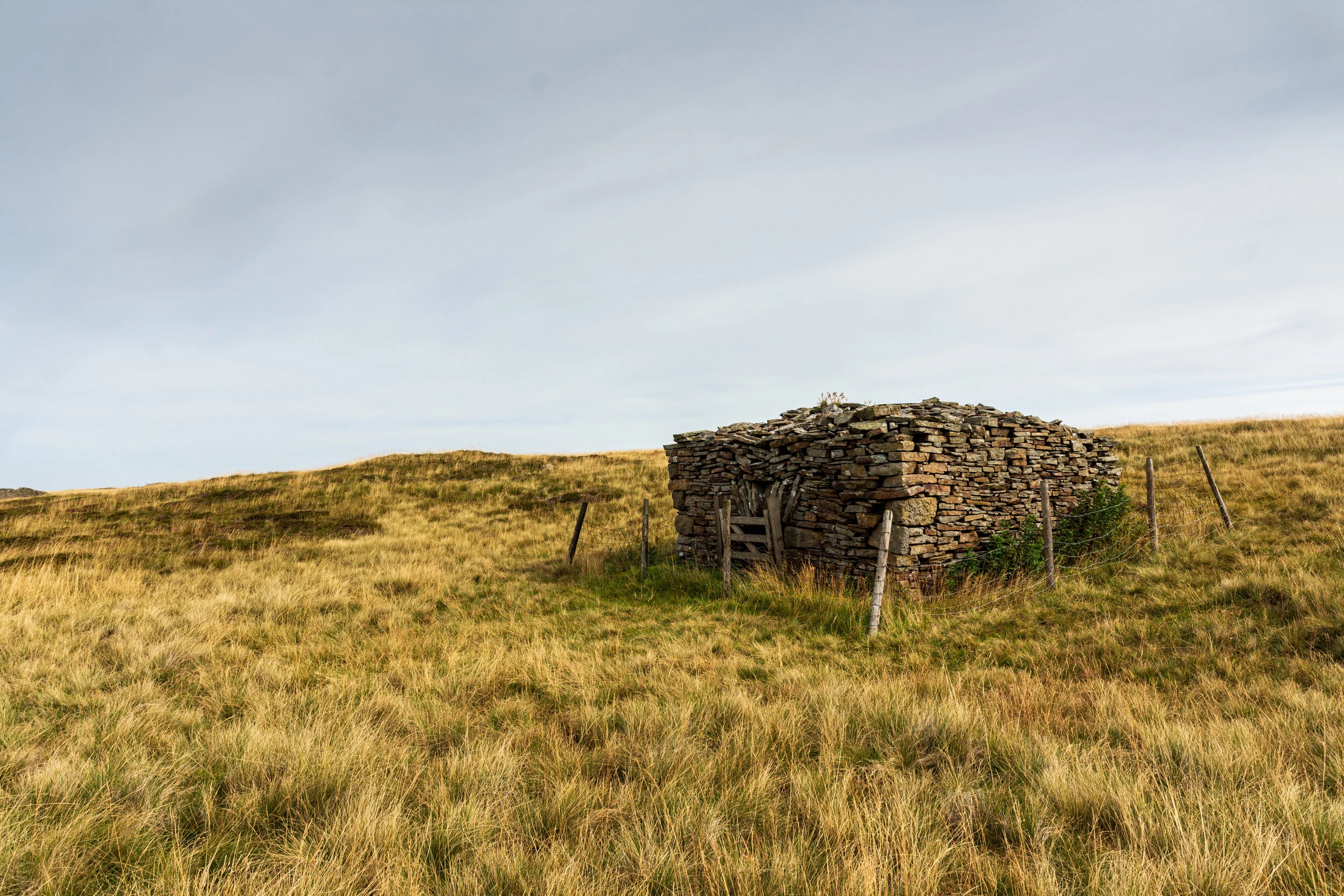
The first is a ‘disused’ weather station, which despite its alluring description on the map is now a pile of rubble with some remains of the inner walls. This is probably the last time you’ll get a view of Malham Tarn in the distance before reaching the summit, but the view of the valley below is stunning. From here it is a short off-path trek to Fountains Tarn, and then off to the summit.

The disused weather station below the summit of Fountains Fell, with Malham Tarn in the distance
The summit as expected is scarred by its mining history, with evidence of spoil heaps, glistening with discarded coal, interspersed with the remaining shafts.

The summit of Fountains Fell, with Pen-y-Ghent and Ingleborough in the background