West Leeds 4-Peaks Challenge
A mega circuit from our homebase of Farsely, this full-day expedition snakes through forests, along canals, across the moors and through villages to visit four well-known summits on the Leeds/Bradford border.
Start and Finish: Village of Farsley, Leeds, SE 218 355
Distance: 45.5km / 28.2 miles
Total Ascent: 860m
Walk Grade: Extreme
Highest Point: Rombalds Moor, 402m (trig point)
Difficulty and Hazards: Three big road crossings, the ring road crossing between Farsley and Calverley at the start can be particularly perilous. Ground can be very muddy throughout. Close to open water (river, canal). Biggest danger here though is fatigue and dehydration, especially in warmer weather
Travel: On the road parking available at walk start in Farsley, plus in villages throughout the walk, if you want to start the circuit somewhere else.
Refreshments: Pubs and food at several points, though no shops until you reach Menston, unless you divery at Apperly Bridge
Accommodation: Some accommodation options in Ilkley, Otley, Menston and Yeadon, though you’ll likely be doing this in a day trip from home
Time: allow 14 hours
Have you ever just set off from your door and walked? Then kept walking and walking until you realised you’d walked really far, and are a long way from home?
Well, that’s how the West Leeds 4-Peaks Challenge was born.
Having walked from Saltarie to Ilkley Moor before, I was convinced that it was possible to walk from Farsley to Ilkley Moor in a day. Maybe this was the vague thought I had in my mind as I set off from home, just before sunrise, on the second day of the year.
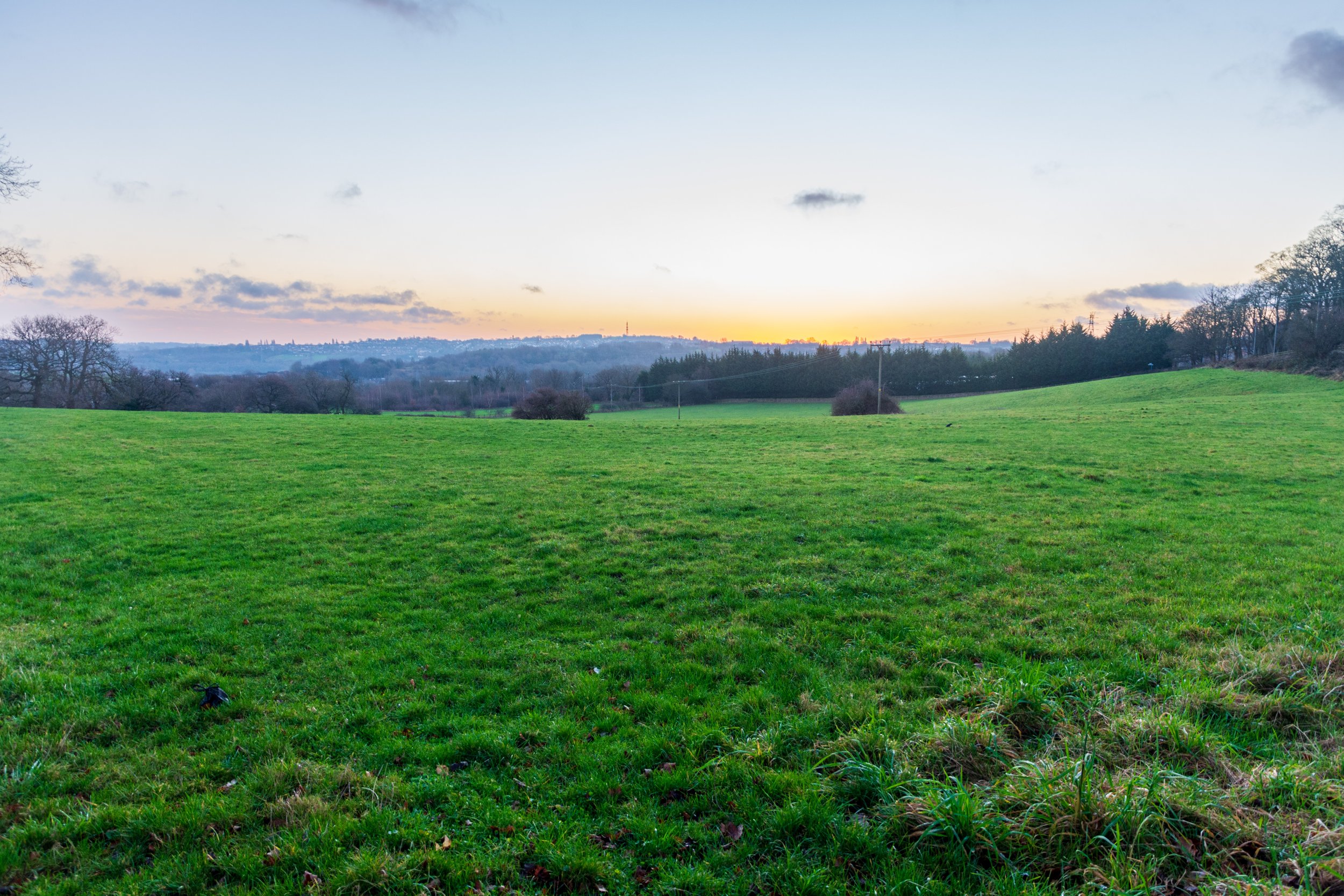
January 2022 was an interesting time. We were still living in the shadow of COVID - most restrictions were being lifted, but this had been the first Christmas where we’d been free to circulate relatively freely, but people were still very cautious. As a result, my little trip on this day was on the back of a week mostly indoors with the family. I was ready for a walk.
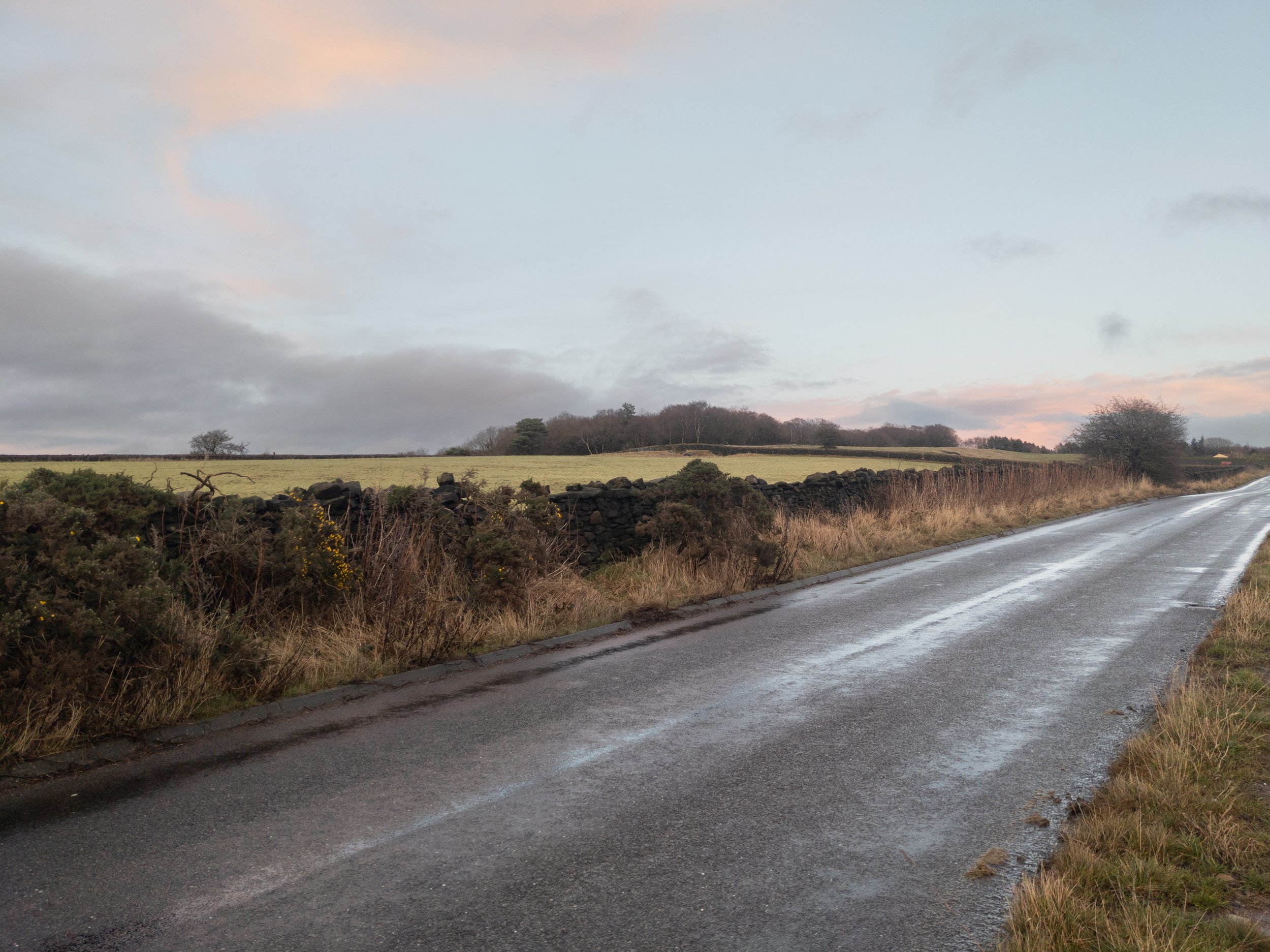
The weather was fine as I left before sunrise. From Farsley, I headed towards neighbouring Calverley, crossing the mercifully quiet Leeds Ring Road. As I headed down the country lane connecting the two villages, the sun peaked over the horizon to the east to light up the sky.
A lovely sunrise over West Leeds, on the road into Calverley
I headed through Calverley and into the family-favourite Calverley Woods. Everyone has their story about the local place they discovered during lockdown: This one is ours. An old, wooded quarry with its own fairy village, carved rocks and rope swings over cliff faces. Like many of these places, it was bustling during lockdown and now it was over, it once again became the domain of the odd runner or dog walker. It was lovely and quiet.

The early morning sun poking through the trees in Calverley Woods
There are a few different routes through Calverley Woods, but ultimately I exited onto Thornhill Drive and headed right to cross the canal, shortly joining the main road, turning left onto this, before crossing, and turning right to join the canal tow path.

The Marina, at Applerley Bridge, on the Leeds Liverpool canal
The path then followed the canal past the Apperley Bridge marina, before crossing another road, and heading out to a set of locks. I continued to follow the canal for some way, walking under a railway bridge, before I took a blink-and-you’ll-miss-it gap into the undergrowth onto a side path that descended towards a footbridge across the River Aire.
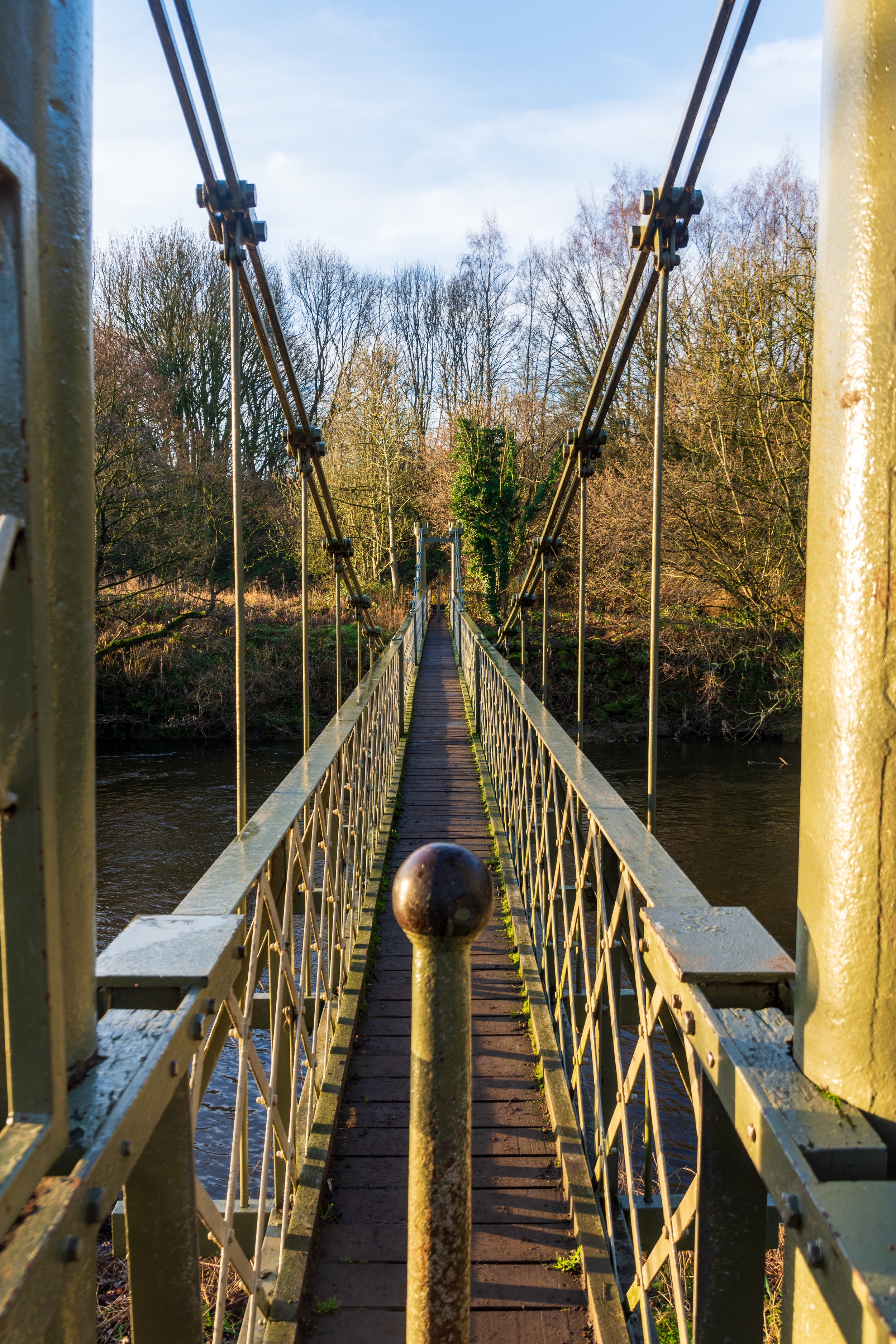
The hidden footbridge, crossing the River Aire, west of Leeds
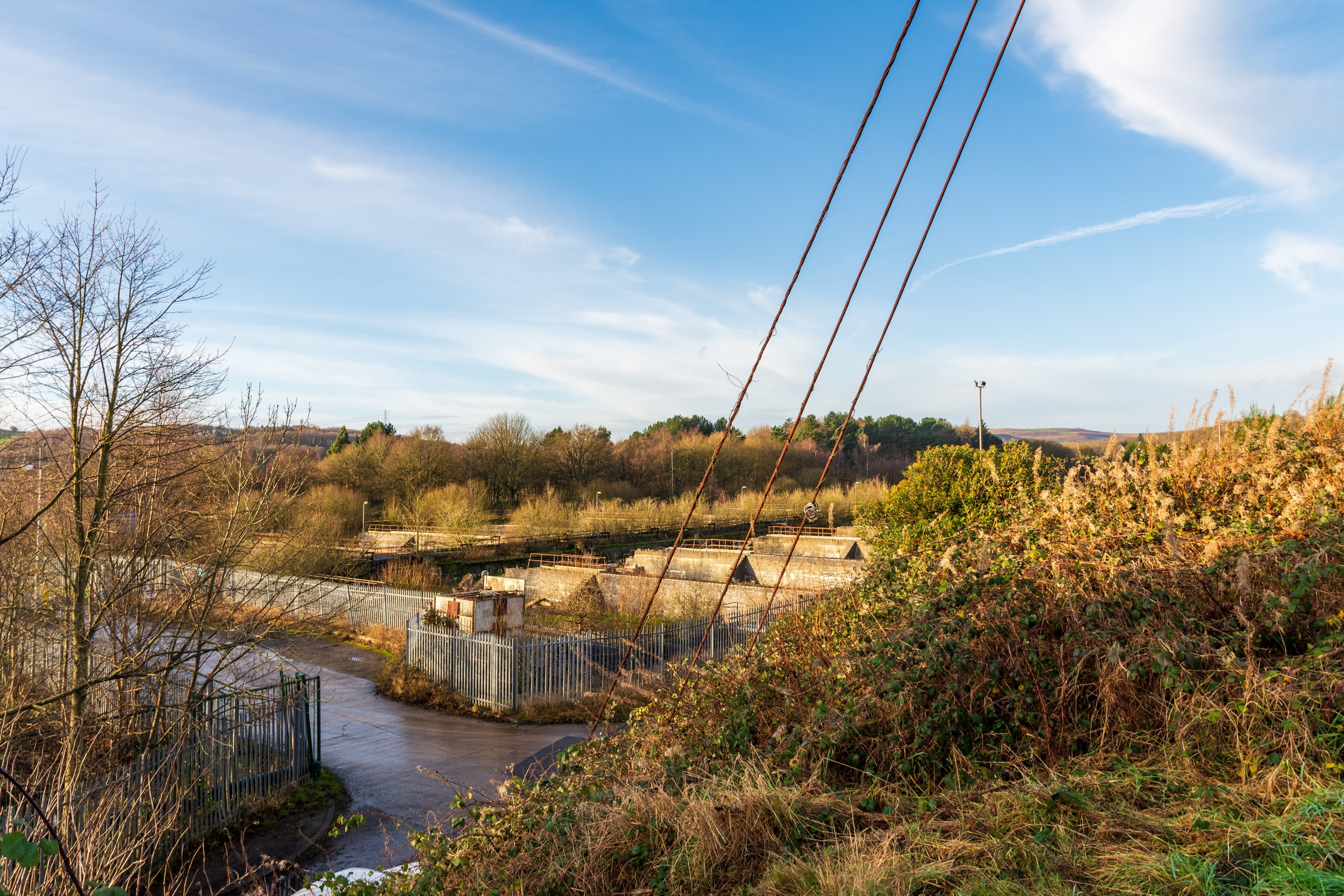
The next section of the route was a curious mix of idyllic river side and industrial land. The path after the bridge headed off to the left, ultimately skirting a wall around a large sewage works. I later learned that this was the second largest sewage works in Yorkshire. Luckily, and I don’t know if it was a result of the time of day or the weather, the smell wasn’t so bad, and the walk was actually fairly pleasant in the morning sun.

The Esholt Water Treatment Works near Leeds, owned by Yorkshire Water
The path soon exited onto a road, and a small office industrial park. I didn’t know at the time, but I was now actually skirting the grounds of the historic Esholt Hall. Still intact, the building is privately owned by Yorkshire Water and currently being redeveloped as a training centre for their staff.
After the industrial park, I took a right turn into the woods, and then headed left. Technically there is no right of way marked on the map here, however the path was being used both by dog walkers and a cycling training school. I followed the path for a couple of km, passing an old, large derelict construction to my left, before emerging in the village of Esholt.
The derelict Press House, in Esholt, Leeds
Esholt’s claim to fame (other than being home to the second largest sewage works in Yorkshire!) is that it was the village used for the outside shots of Emmerdale from 1976 to 1996. The pub still bears the name of ‘The Woolpack’ (this was changed by the landlord at the time from ‘The Commercial Inn’ as he allegedly got tired of having to keep changing the sign for filming!).
I passed through the village before taking a small road up a hill to the right. The road becomes a smaller track, leading to the busy A6038 between Guisley and Baildon.

Baildon Hill in the distance
After crossing the road, I continued up the track, crossing the railway, and entering the Hollins Hall Golf Club. The right of way took me off to the left, down the side of the course, with my next target of Baildon hill looming in front of me. I continued through the golf course, exiting via a stile at the end of the field. A left turn here saw me briefly circle a small pond, before turning right, following the outside edge of a rugby pitch. The path then ascended through some woods, before emerging on a hillside, which was effectively one of the lower slopes of Baildon Hill. I continued to head up the hill, joining a track before cutting through some stables, and then joining a road. I followed this a short way, before heading right onto a craggy outcrop, where I rested and took in the views.
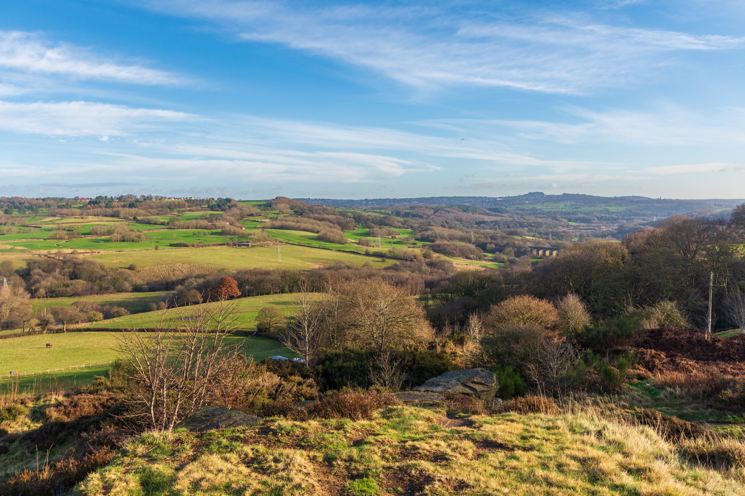
A stunning view back across the journey so far, from Baildon Hill, with my last peak of The Billing in the background
This was probably the finest view of the day. Looking back down into the valley and towards Leeds, I traced the route I had taken so far, through Esholt and Calverley Woods. The sun shone bright, the air had warmed, and I took in the scene before me.
I then headed on to the lower of the two trig points on Baildon Hill, before crossing the road, and heading across another golf course (a golf course on open access moorland!), and climbing to the second trig point on its summit.

The lower trig point on Baildon Hill
The views here are always enjoyable, and it was incredibly satisfying to know that I had made my way here from home, all on foot. 16km covered so far, and it wasn’t even quite midday.

The higher trig point on Baildon Hill
I decided to press on to Ilkley Moor. It remained firmly in the distance, but I had done this leg before, when I previously tackled Baildon Hill and Ilkely Moor together from Saltaire. I descended from the summit of Baildon Hill, and crossed the road to a car park near the club house for the golf course. I then followed the course into its bottom right corner. I turned right onto a track, leading up to a horse-training farm, recognisable by the large stone tracks around its perimeter. I followed the right of way to the left, follwoing the track for some way, before crossing into a field to join the Dales Way Link path. I followed this for another half kilometre, before emerging on the road. I turned left and continued along the road until the pub, and then took a stile to my right to rejoin the Dales Way link path.

Looking up to the shooting lodge on Ilkely Moor, the weather is on the turn!
I soon found myself back on the moors, and found a scenic spot for some lunch. The sun had gone in and clouds had started to build, but plenty of blue sky hung around. To my east was a clear view of my later targets of The Chevin and The Billing - the latter seeming incredibly far away right now.
I packed up and continued on up the moor.
It may have started with a couple of drops, about 1 km after my lunch stop, but the rain came in very quickly. I took a left path away from the Dales Way Link to head up to the trig point at the top of Rombalds Moor. Within minutes I was in full waterproofs, and after a few minutes more, I was trudging my way up a very muddy hill. I followed the wall towards the summit, and soon I could see the trig point nearby. I took a path off to my right towards it, and arrived at the top, very, very wet.

Where has the good weather gone? Decidedly wet on the summit of Rombalds Moor / Ilkley Moor
I’d have liked to have said I now looked towards my next target of The Chevin, but visibility was now poor, and the winds were blowing around me. I wasted little time at the top, other to pose for a quick selfie, before trudging along the stone path towards the Twelve Apostles. On arriving at them some 15 minutes later, I didn’t even stop as I snapped a quick photo on the move, and continued on.

The drenched Twelve Apostles on Ilkley Moor
The Chevin was now starting to emerge from the gloom, and it did seem surprisingly close now. I continued to follow the track across the moor, first to the shooting lodge, and then on to the moor’s Eastern Edge, passing a lovely remote house, and eventually emerging on the road just south of Burley Woodhead.

Heading along Ilkley Moor, towards The Chevin
I turned left and followed the road for a short distance. For all the times I’ve driven down this road, it looked totally unfamilar on foot. After a short walk, I turned right onto Moor Lane, which descended past fields and headed towards Menston.
It was the first time I had visited Menston, and it came across as a charming little place, with warm, gently lit windows, interesting looking shops and fairy lights twinkling in the late-afternoon gloom. Everything was closed, and it was quiet, save from the odd car, as most sane people were enjoying one last day at home before January kicked into gear. For the first time on the walk, I realised just how far away from the warmth of home and family I now was, and felt a pang of lonliness. It didn’t help that I’d long-since burned through my rations for the day, and pangs of hunger reamined unsaited, as wafts of home cooking filled the air.
I weaved through the streets of Menston, and soon hit the A65, a roaring cacophony of traffic compared to the peace of the village. I darted across the road when I could, and crossed the footbridge over the railway tracks. Emerging on the other side, the ascent of The Chevin was now immediately before me.
Approaching the summit of The Chevin
I followed the road up the hill for a short distance, before crossing into the woods for the final part of the ascent. The sky grew darker as night approached, and I finally emerged at Surprise View just before sunset

Beautifully lit West Leeds and Leeds Bradford Airport from The Chevin
With darkness fast approaching, I didn’t linger for long. I felt as far away from home as I had been all day. As it happened, three quarters of the walk was now behind me, and I was now, for the first time today, heading directly back towards home, but I was still a good 2-3 hours away from light and warmth.
I hurried down, crossed the road near the Chevin Lodge, and followed the long track down to Yeadon. I wasn’t hanging about now, and decent, gently descending track meant I covered the next few kilometres with realtive ease. I managed to get to the outskirts of Yeadon in failing light, but before needing the headtorch.
Yeadon was a bustling metropolis compared to Menston earlier. The roads were busy with early evening traffic, and takeaways had opened their doors, offering enticing treats that my empty stomach longed for. I pressed on through the village, crossing the busy A658, and it was a relief when I finally took a path away from the road, and on towards The Billing, the final peak of the day.
I had never appraoched The Billing from this direction before, and took some time to find the right (very muddy) paths through the fields. I recognised the shadows of the trees at the summit in front of me, and headed towards them.
The actual summit of The Billing is about 20m higher than the nearby trig point, and with such a huge effort to climb the peaks so far, I didn’t want to miss the last one on a technicality!
It was very dark now, and Leeds lay twinkling across the valley below

Proper dark now! Looking over Leeds, from The Billing
One of the lights below me was home, and I longed for its warmth and comfort. I had now gained a sense of perspective of the remaining part of the walk - I had walked this part of the route, from home, countless times before. I knew I was still an hour from home. But I was on familiar ground. I knew every step of the way.
After passing the trig point, I descended to Rawdon, and then through muddy fields, skirted Horsforth, before crossing the A65 once more. There wasn’t really much to see now, with my surroundings in pitch black, as I crossed the River Aire, followed the canal back to Rodley, and made the final short but sapping ascent into Farsley and home.